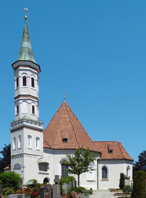

Die Tour führt auf ruhigen Wegen zu den schönsten Kapellen im Osten von Weilheim.
-
Aufstieg: 166 hm
-
Abstieg: 166 hm
-
Länge der Tour: 26,5 km
-
Höchster Punkt: 664 m
-
Differenz: 119 hm
-
Niedrigster Punkt: 545 m
Schwierigkeit
mittel
Kondition
mittel
Panoramablick
viel
Saisonale Eignung
-
JAN
-
FEB
-
MRZ
-
APR
-
MAI
-
JUN
-
JUL
-
AUG
-
SEP
-
OKT
-
NOV
-
DEZ
Merkmale Touren
Aussichtsreich
Rundweg
Einkehrmöglichkeit
Kulturell / historisch


Hier befindet sich auch


Essen in der Nähe
"Essen in der Nähe" überspringen

ca. 0,4 km entfernt
Gelateria und Pizzeria Emporio
Schmidstraße 20, 82362 Weilheim, Germany
Ob auf einen schnellen Espresso oder einen gemütlichen Cappuccino mit italienischen Leckereien, hier ist jeder herzlich willkommen! Probieren Sie auch Eis und Patisserieprodukte aus eigener Herstellung. Und für den etwas größeren Hunger wartet traditionell mediterrane italienische Küche auf die Besucher.

ca. 0,5 km entfernt
Restaurant La Ruota
Kreuzgasse 10, 82362 Weilheim, Germany
Lassen Sie sich verwöhnen und genießen Sie Ihre Auszeit in Weilheim im Restaurant La Ruota.
ca. 0,5 km entfernt
Restaurant Korfu
Kreuzgasse 7, 82362 Weilheim, Germany
Griechisches Restaurant mit Biergarten in der Weilheimer Innenstadt.

ca. 0,5 km entfernt
Gasthof Allgäuer Hof
Marienplatz 17, 82362 Weilheim, Germany
Der Allgäuer Hof ist eine traditionelle bayrische Gaststätte im Zentrum Weilheims (in Oberbayern).

ca. 0,6 km entfernt
Tapas-Bar Torito
Admiral-Hipper-Str. 18, 82362 Weilheim, Germany
Herzlich Willkommen im Torito – TAPAS Y MAS! Im „Kleinen Stier“ gibt es Tapas und mehr! Bis 19 Uhr gibt es eine kleine Tapa zu jedem Getränk.

ca. 0,7 km entfernt

ca. 0,7 km entfernt
Hotel Restaurant Pöltner Hof Weilheim
Pollinger Str. 4 & 6, 82362 Weilheim in Oberbayern, Germany
Die zentrale Lage im Zentrum von Weilheim und die schmackhafte Küche lockt Gäste von Nah und Fern in unser Restaurant. Reservieren Sie Ihren Tisch online.


ca. 1,8 km entfernt
Trifthofstüberl
Trifthofstr. 57, 82362 Weilheim, Germany
In diesem gemütlichen und rustikalen Lokal wird Ihnen gutbürgerliche Küche serviert. In zwei getrennten Räumen ist Platz für bis zu 50 Personen. Am separaten Imbiss im separaten vorderen Bereich können Sie täglich (ausser Wochenende) ab 7.00-14:00 Uhr frisch zubereitete Speisen mitehmen.

ca. 2,4 km entfernt
Caro‘s Gutscafé & Hofladen
Dietlhofen 1, 82362 Weilheim, Germany
„Lass uns heute Kaffee trinken und im Hofladen ein Bisonfell kaufen.“ Na klar, das geht hier in Caros Gutscafe auf Gut Dietlhofen.

ca. 2,5 km entfernt
Hofgarten Pfaffenwinkel
Dorfstraße 4, 823662 Weilheim - Unterhausen, Germany
Auf einem besonders schönen Flecken Erde befindet sich der Hofgarten Pfaffenwinkel mit seinem idyllischen Café.

ca. 3,5 km entfernt
Klosterwirtschaft
Weilheimer Str. 12, 82398 Polling, Germany
Die Alte Klosterwirtschaft ist ein ideales Ausflugsziel im oberbayerischen Pfaffenwinkel.

Unterkünfte in der Nähe
"Unterkünfte in der Nähe" überspringenca. 0,3 km entfernt
Wohnmobilstellplatz Weilheim
Lohgasse 17, 82362 Weilheim, Germany
Hinweis: im Ort den Reisemobil-Piktogrammen zum Stellplatz folgenGPS-Koordinaten: N 47° 84‘ 00" / O 11° 13‘ 63"Der In weniger als 500 Meter Entfernung vom Wohnmobilstellplatz befinden sich: Ufer der Ammer mit Fuß- und Radweg nach Norden und Süden Naherholungsgebiet „Au“ mit neu angelegtem Fitness-Parcours für Jung und Alt Weilheims historische Altstadt mit zahlreichen Einkaufs- und Einkehrmöglichkeiten Lebensmittel-Discounter in der Lohgasse


ca. 1,4 km entfernt
Ferienwohnung Elisabeth
Wettersteinstraße 8, 82362 Weilheim i. OB, Deutschland


ca. 7,2 km entfernt


ca. 7,4 km entfernt
Weitere Tipps in der Nähe
"Weitere Tipps in der Nähe" überspringen")


ca. 0,1 km entfernt
Eibenwaldrunde
Die gemütliche Tour führt westlich von Weilheim bis zum Paterzeller Eibenwald und über Zellsee wieder zurück.
2:30 h 134 hm 134 hm 24,0 km mittel

ca. 0,3 km entfernt
STARlight Weilheim
Schützenstraße 4, 82362 Weilheim, Germany
Achtung! Kartenreservierung per Email nicht möglich!


ca. 0,5 km entfernt
Marienplatz - Weilheims gute Stube
Marieplatz, 82362 Weilheim in Oberbayern, Germany
Der gepflegte Platz inmitten von Weilheim lädt zum Verweilen in einem der vielen Cafés und Gaststätten ein.


ca. 0,5 km entfernt
Gravelbiken mit Zugspitzblick - Hoher Peißenberg und wilde Ammer (Weilheim-Schongau)
Auf dieser Gravelbike-Tour startest du in Weilheim, passierst die Erdefunkstelle Raisting, erklimmst den Hohen Peißenberg und entdeckst die idyllische Wilde Ammer bis nach Schongau.
4:50 h 865 hm 744 hm 66,9 km mittel


ca. 0,6 km entfernt
Etappe 2, Ostschleife, Heilige Landschaft Pfaffenwinkel - Von Weilheim nach Bernried
Die zweite Etappe des Fernwanderwegs der Ostschleife Heilige Landschaft Pfaffenwinkel führt uns von Weilheim in Oberbayern nach Bernried. Weitläufige Moor- und Sumpfgebiete, idyllische Seen und malerische Wälder begleiten den Weg zum Starnberger See. Auf dieser Etappe führen uns die Vielzahl an Kapellen und Kirchen vor Augen, wie der Pfaffenwinkel zu seinem Namen kam.
5:45 h 212 hm 181 hm 22,5 km mittel

ca. 0,6 km entfernt
Etappe 6, Nordschleife, Heilige Landschaft Pfaffenwinkel - Von Weilheim nach Peißenberg
Die sechste Etappe des Fernwanderwegs Heilige Landschaft Pfaffenwinkel Nordschleife führt uns von Weilheim nach Peißenberg. Falls wir nach der langen fünften Etappe keine Zeit mehr hatten, Weilheim zu besichtigen, so lässt uns die nicht ganz so lange, sechste Etappe dafür genug Zeit im Vorfeld noch durch die Fußgängerzone und über den Marienplatz zu flanieren, die Stadtpfarrkirche Mariae Himmelfahrt zu besuchen und die Kirche St. Pölten - die älteste Weilheimer Kirche, deren Ursprünge bis ins 8. Jh. zurück gehen zu bestaunen. Danach machen wir uns auf den Weg nach Peißenberg. Unterwegs treffen wir erneut auf die Ammer und können in Polling das sehenswerte Klosterdorf (Kloster Heilig Kreuz) und die Stiftskirche St. Salvator der Augustiner Chorherren besuchen.
3:45 h 157 hm 141 hm 12,4 km mittel
ca. 0,6 km entfernt

Das könnte Dir auch gefallen
"Das könnte Dir auch gefallen" überspringen

Radpilgern durch Pfaffenwinkel und Zugspitz Region: Weitblicke - Vom Hohen Peißenberg zu spiegelnden Wassern
Diese Runde ist der Himmel. Ihm kommt man ganz nah auf dem Hohen Peißenberg mit seiner über 500 Jahre alten Wallfahrtskirche und einem der schönsten Rundblicke Bayerns.
7:00 h 931 hm 931 hm 94,9 km

Genussrundtour zur Wieskirche
Abwechslungsreiche Rundtour zur Wieskirche mit herrlichen Ausblicken
1:10 h 122 hm 117 hm 14,9 km mittel


Panorama-Runde Schlosspark
Der Name spricht Bände - neben den wunderbaren Ausblicken auf Forggensee, Lech, Schloss Neuschwanstein und die Tannheimer Berge locken entlang dieser Runde auch näherliegende Schönheiten wie die Wieskirche, Badespaß am Illasbergsee oder das Premer Filz. Hier gibt es für alle, die nicht nur gern radeln sondern auch wandern, einen Moorlehrpfad.
3:05 h 300 hm 299 hm 41,3 km mittel


Fernradweg Romantische Straße
Auf einer Länge von 500 Kilometern verläuft derRadfernweg parallel zur Romantischen Straße aufschwach befahrenen Nebenstrecken,Ortsverbindungsstraßen, Flurbereinigungs- undWaldwegen. Der Radfernweg D9 „RomantischeStraße“ wurde vom ADFC 2013 mit 3 Sternenausgezeichnet und ist sorgfältig und durchgehendausgeschildert, als Rad-Weitwanderweg hat er sichin dieser Streckenführung seit den 80-er Jahrenbewährt.
32:37 h 2178 hm 1547 hm 496,5 km mittel

Knappensteig
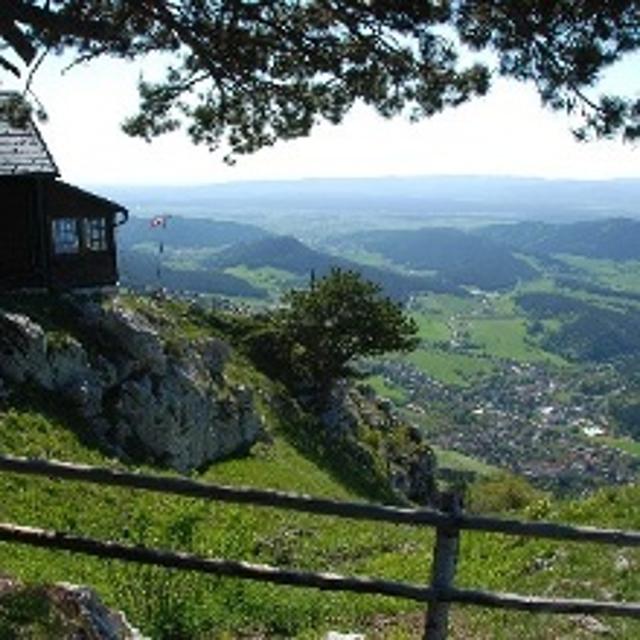
Der Knappensteig verbindet den ausgeschilderten Stollenweg mit einer Besteigung des Hohen Peißenbergs, dem Panoramaberg im Pfaffenwinkel schlechthin. Entlang des mit zahlreichen Informationstafeln ausgestatteten Lehrpfads erfahren Wanderer interessante Details zum Bergbau rund um Peißenberg. Bei klarer Sicht reicht der Blick vom Hohen Peißenberg von den Chiemgauer Alpen über das Ester- und Wettersteingebirge bis zu den Ammergauer und Allgäuer Alpen. Beschildert: Nr. Nr. 83, rot
5:15 h 681 hm 681 hm 17,6 km sehr schwer


Winterwanderung - Auf den Hohen Peißenberg
Der Wanderweg zum Hohen Peißenberg ist eine anspruchsvolle Tour mit vielen Höhenmetern. Wenn der Berggipfel erreicht ist, wartet eine Vielzahl an Sehenswürdigkeiten und ein herrlicher Rundumblick auf erkundungsfreudige Wanderer. Die Wallfahrtskirche, das Observatorium und der Fernsehturm sind nur einige der Attraktionen. Für junge Wanderer ist der Wetterlehrpfad eine spannende Reise in die Welt des Klimas. Beschildert: Nr. 77, blau
3:30 h 380 hm 380 hm 10,7 km mittel
Winterwanderung - Knappensteig
Der Knappensteig verbindet den ausgeschilderten Stollenweg mit einer Besteigung des Hohen Peißenbergs, dem Panoramaberg im Pfaffenwinkel schlechthin. Entlang des mit zahlreichen Informationstafeln ausgestatteten Lehrpfads erfahren Wanderer interessante Details zum Bergbau rund um Peißenberg. Bei klarer Sicht reicht der Blick vom Hohen Peißenberg von den Chiemgauer Alpen über das Ester- und Wettersteingebirge bis zu den Ammergauer und Allgäuer Alpen. Beschildert: Nr. Nr. 83, rot
5:15 h 533 hm 533 hm 17,6 km sehr schwer

Pfaffenwinkel Radrundfahrt, 160 km
Wir verlassen Peiting in Richtung Schongau. Vorbei an Altenstadt, Sachsenried, Rettenbach, Bernbeuren und dem Auerberg erreicht man Lechbruck. Weiter geht es über Prem, die Wieskirche nach Rottenbuch. Im weiteren Verlauf führt die Route über Schöffau und den Staffelsee wieder Richtung Norden nach Weilheim. Weiter in östliche Richtung erreicht man den Zellsee, Forst und Herzogsägmühle wieder den Ausgangspunkt Peiting.
10:25 h 1235 hm 1241 hm 145,3 km sehr schwer


Land der Moore - Radeln zwischen Bad Kohlgrub und Benediktbeuern
Das Alpenvorland zählt zu den faszinierendsten Landschaften Deutschlands, und sogar ganz Europas.
6:20 h 498 hm 498 hm 91,1 km sehr schwer


Lechtour: über Riesen -Burggen zurück nach Steingaden
Abwechslungsreiche Rundtour mit Überquerung der Lechtalbrücke Schongau und interessanten Ausblicken. Besuchen Sie vor der Befahrung der Lechtalbrücke die Villa Rustica in Peiting. Die historische Ausgrabungsstätte eines römischen Landgutes aus dem 2. Jahrhundert n. Chr.
2:25 h 223 hm 223 hm 32,7 km


Fernradweg Via Claudia Augusta in Bayern
Bayerisch-Schwaben: Beliebter Fernradweg - Wo einst die Römer reisten...
12:00 h 727 hm 326 hm 172,5 km sehr schwer

Bergwerkstour
Diese Radtour führt durch lauter ehemalige Bergbauorte. Alle drei Orte verfügten über ein Kohlebergwerk und wurden dadurch jahrzehntelange geprägt. Mittelschwere Tour mit längerem Anstieg von Peißenberg zurück nach Hohenpeißenberg. In Hohenpeißenberg bietet sich ein herrlich Blick auf die Alpenkette. Der Abstecher auf den Bayerischen Rigi ist empfehlenswert.
2:00 h 281 hm 281 hm 27,1 km mittel

Bergwetter-Weg
In exponierter Lage führt die Spazierrunde auf gut beschilderten Wegen zu den spannenden Sehenswürdigkeiten des Hohen Peißenbergs. Auf der Runde erwartet uns die älteste Bergwetterstation der Erde, eine Entdeckungsreise durch die Welt des Klimas und die Wallfahrtskirche Maria Himmelfahrt. Beschildert: Nr. 82, blau
1:30 h 196 hm 196 hm 4,8 km sehr leicht

Kirchen-Rundweg Iffeldorf
Das Ziel des kurzen Rundwegs ist die Wallfahrtskirche St. Maria im Heuwinkl. Die als Heuwinklkapelle bekannte Kirche liegt wunderschön auf einer Anhöhe östlich von Iffeldorf. Sie gilt als eine der schönsten Kapellen im gesamten bayerischen Oberland. Durch ihre exponierte Lage und ihren originellen runden Bau mit der großen roten Kuppel ist sie schon von Weitem sichtbar. Beschildert: Nr. 24, grün
0:45 h 39 hm 39 hm 2,8 km sehr leicht

Peitnachrunde
Die Tour führt von Peiting zum Kalvarienberg und an der Peitnach entlang. Eine malerische Runde mit Alpenblick und Sicht auf den Hohen Peißenberg. Vor allem für Familien mit Kindern ist der Walderlebnispfad auf dem Kalvarienberg ein spannendes Erlebnis. Beschildert: Nr. 100, grün
2:00 h 147 hm 149 hm 6,4 km mittel

Römer und Welfen am Lech - Peiting
Auf dem bergigen Rundweg zwischen Schongau und Peiting folgt ein Highlight dem anderen. Am Schlossberg und an der Villa Rustica wandeln Wanderer auf den Spuren von Römern und Welfen, auf dem Walderlebnispfad warten spannende Stationen zum Mitmachen auf große und kleine Besucher und dazwischen eröffnen sich immer wieder grandiose Blicke auf die Alpenkette und den türkis leuchtenden Lech.
4:00 h 359 hm 359 hm 13,7 km mittel

Stadt- und Waldrunde
Die ausgedehnte Stadt- und Waldrunde in und um Penzberg wartet mit abgelegenen Aussichtspunkten, traumhaften Gewässen und weitläufigen Filzgebieten in Stadtnähe auf. Im Erholungsgebiet Berghalde wandert man auf den Spuren des Bergbaus und erfährt Wissenswertes zur Geschichte der Stadt Penzberg. Für junge Wanderer ist das Freizeitgebiet Gut Hub eine spannende Abwechslung. Beschildert: Nr. 1, rot
4:45 h 225 hm 225 hm 18,2 km mittel

Wald- und Weiherschleife
Die ausgedehnte Wald- und Weiherschleife, verläuft auf abwechslungsreichen Wegen mit vielen Sehenswürdigkeiten um Penzberg, die Stadt der 74 Nationen. Die Wanderung führt an landschaftlich reizvollen Plätzen vorbei, an romantischen Seen entlang und zu historischen Baudenkmälern. Auf dieser Runde präsentiert sich der Pfaffenwinkel von seiner schönsten Seite. Beschildert: Nr. 2, rot
4:30 h 242 hm 242 hm 16,4 km mittel

Wanderweg zum Hohen Peißenberg
Der Wanderweg zum Hohen Peißenberg ist eine anspruchsvolle Tour mit vielen Höhenmetern. Wenn der Berggipfel erreicht ist, wartet eine Vielzahl an Sehenswürdigkeiten und ein herrlicher Rundumblick auf erkundungsfreudige Wanderer. Die Wallfahrtskirche, das Observatorium und der Fernsehturm sind nur einige der Attraktionen. Für junge Wanderer ist der Wetterlehrpfad eine spannende Reise in die Welt des Klimas. Beschildert: Nr. 77, blau
3:15 h 381 hm 381 hm 10,7 km mittel
Winterwanderung - Bergwetter-Weg
In exponierter Lage führt die Spazierrunde auf gut beschilderten Wegen zu den spannenden Sehenswürdigkeiten des Hohen Peißenbergs. Auf der Runde erwartet uns die älteste Bergwetterstation der Erde, eine Entdeckungsreise durch die Welt des Klimas und die Wallfahrtskirche Maria Himmelfahrt. Beschildert: Nr. 82, blau
1:45 h 187 hm 187 hm 4,8 km sehr leicht