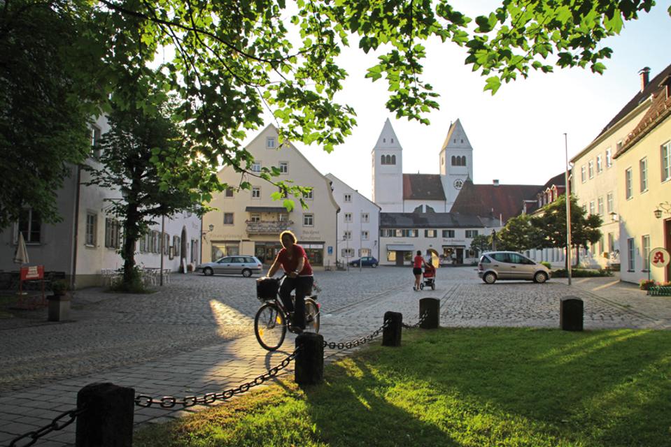

Die Schleife führt Radler durch die südwestlichste Ecke des Pfaffenwinkels.
-
Aufstieg: 211 hm
-
Abstieg: 211 hm
-
Länge der Tour: 30,2 km
-
Höchster Punkt: 882 m
-
Differenz: 166 hm
-
Niedrigster Punkt: 716 m
Saisonale Eignung
-
JAN
-
FEB
-
MRZ
-
APR
-
MAI
-
JUN
-
JUL
-
AUG
-
SEP
-
OKT
-
NOV
-
DEZ
<p>Kostenloser Parkplatz Kissingerstraße.</p>
B17 nach Steingaden.
Mit öffentlichen Verkehrsmitteln:
Bahnanreise nach Weilheim, Schongau, Peiting, Füssen oder Saulgrub. Von diesen Bahnhöfen RVO-Buslinien 9606 (von Füssen und Saulgrub/Garmisch-Partenkirchen), 9651 (von Weilheim i.OB) und 9822 (von Schongau/Peiting) nach Steingaden.
Alternativ zur Busfahrt ist es auch möglich, mit der Bahn bis Peiting Ost zu fahren und bereits ab dort mit dem Fahrrad zu starten (Tour Land der Moore: Radeln zwischen Lech und Ammer)
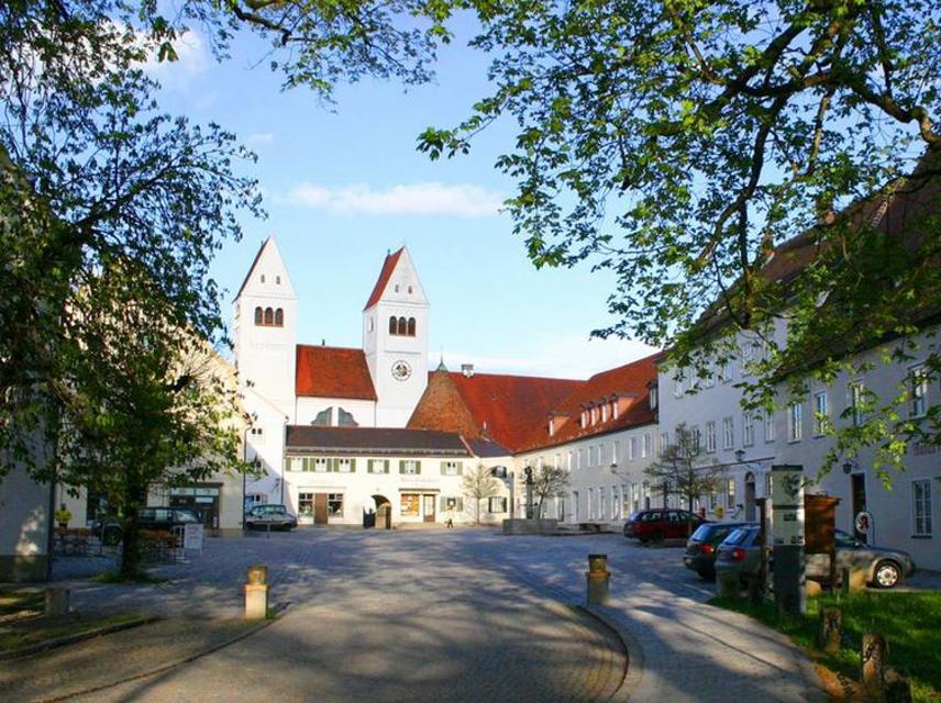
Startpunkt: Marktplatz Steingaden
Ziel: Marktplatz Steingaden
Navigation starten:


Hier befindet sich auch


Tourist Information Steingaden
Krankenhausstraße 2, 86899 Steingaden, Germany
Herzlich Willkommen in Steingaden!


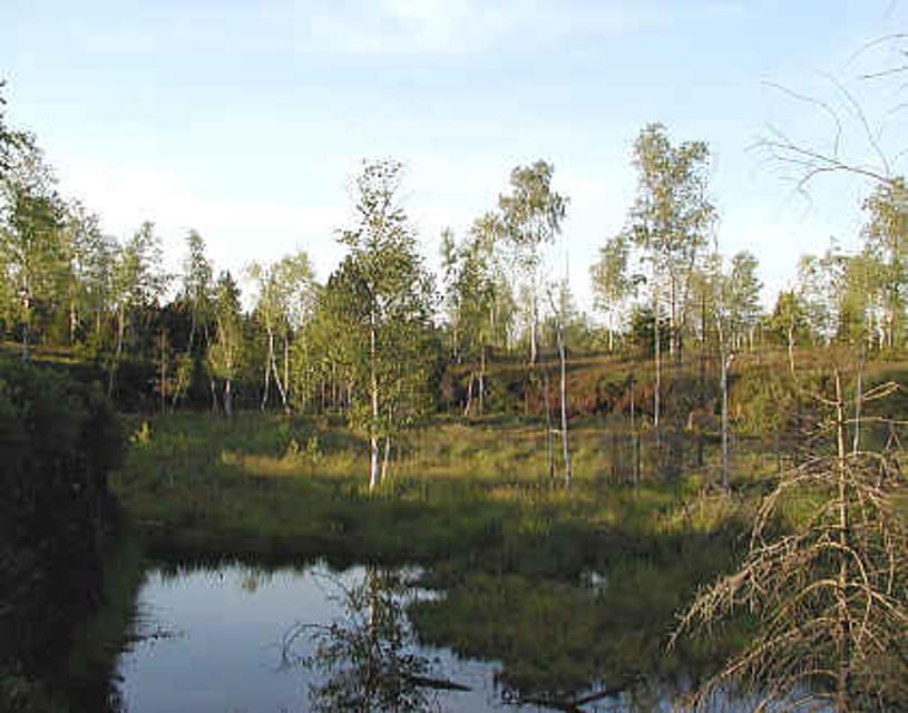
Premer Filz
86984 Prem, Germany
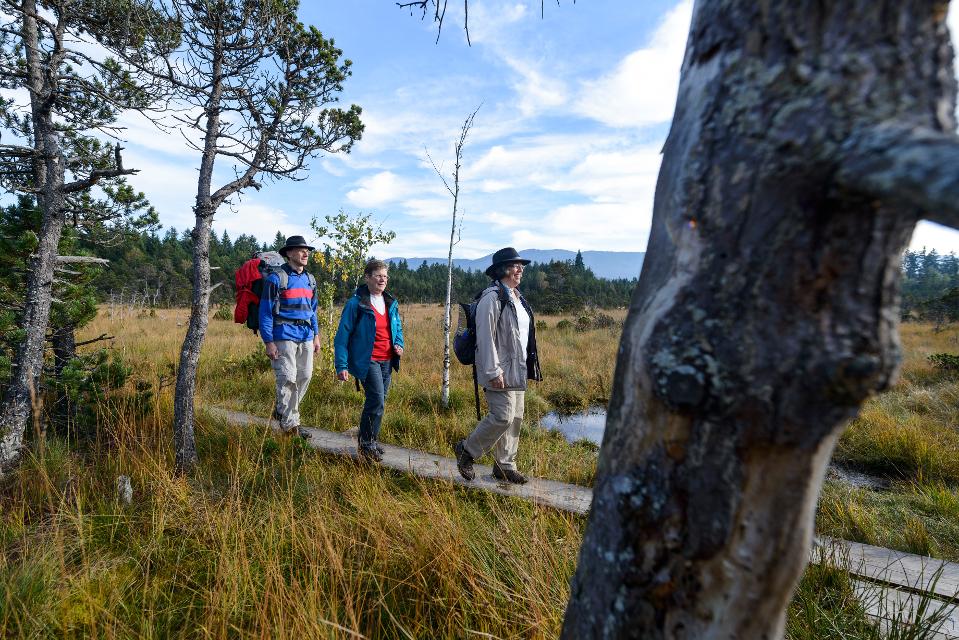
Eine interessante Wanderung durch den Moorlehrpfad mit herrlichem Ausblick auf das Moor. Der Moorlehrpfad ist eine interessante Wanderung mit herrlichem Ein- und Ausblicken auf das Premer Filz. Die Wanderung führt über den Moorlehrpfad, an dem auf Informationstafeln viel Wissenswerte über das Premer Filz zu erfahren ist. Wunderschöne Einblicke in das Moor geben der Wanderung ihren Reiz.


Magdalena
Obere Dorfstraße 23, 86984 Prem, Germany
Ein wunderschöner Blumenladen mit einem recht großen Café lädt zum Verweilen und Genießen ein.

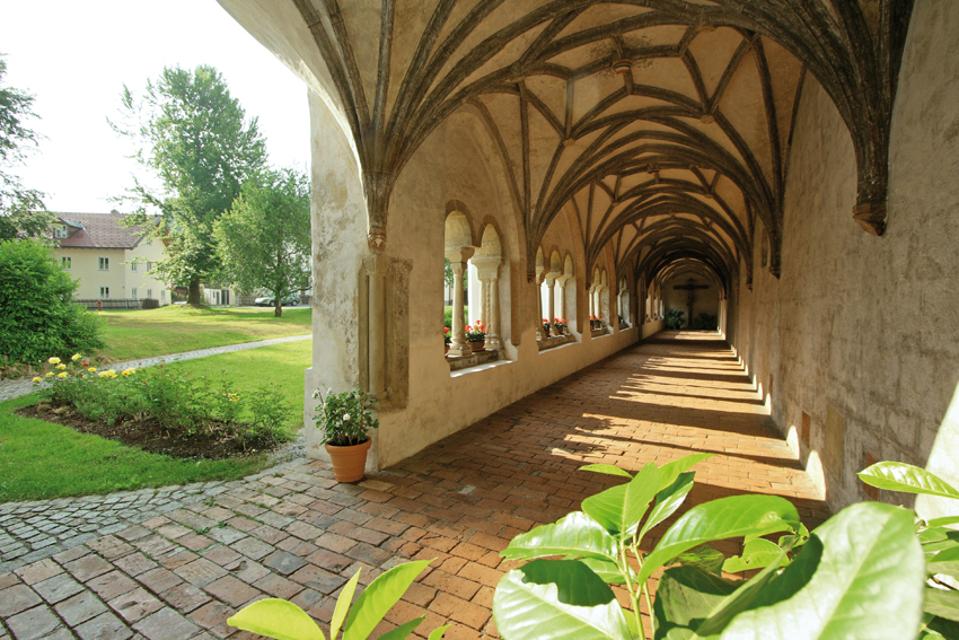
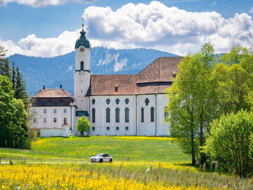
Wieskirche - Wallfahrtskirche zum Gegeißelten Heiland auf der Wies
Wies 12, 86989 Steingaden, Germany
Die Wieskirche bei Steingaden ist eine der berühmtesten Rokokokirchen der Welt. Seit 1983 ist die Wieskirche UNESCO-Welterbestätte. Die Mitte dieses Gotteshauses ist die Figur des leidenden Christus, des Gegeißelten Heilandes.


Gaststätte Moser
Wies 1, 86989 Steingaden, Germany
Öffnungszeiten: Täglich von 9.oo bis 19.oo Uhr Warme Küche von 11.3o bis 17.oo Uhr Mittwoch Ruhetag

Essen in der Nähe
"Essen in der Nähe" überspringen
ca. 2,4 km entfernt
Gasthaus zur Illach
Illach 1, 86989 Steingaden, Germany
Uriger und schöner Biergarten direkt an der Illach bei Steingaden
ca. 3,5 km entfernt
Gaststätte Moser
Wies 1, 86989 Steingaden, Germany
Öffnungszeiten: Täglich von 9.oo bis 19.oo Uhr Warme Küche von 11.3o bis 17.oo Uhr Mittwoch Ruhetag

ca. 5,3 km entfernt
Bayerischer Weißwurst-Stadl
Flößerstraße 11, 86984 Prem, Germany
In einem gemütlichen "Weißwurst-Stadl" können Gäste frisch produzierte Weißwürste genießen.
ca. 5,4 km entfernt
Magdalena
Obere Dorfstraße 23, 86984 Prem, Germany
Ein wunderschöner Blumenladen mit einem recht großen Café lädt zum Verweilen und Genießen ein.

ca. 7,3 km entfernt

ca. 7,6 km entfernt
Hofcafä Burggen
Ziegler 2, 86977 Burggen, Germany
Das ist ja cool! Das ist meist die erste Reaktion von Radlern und Wanderern, die „zufällig“ amHofcafä vorbeikommen. Da steht ein Bauwagen mit herrlich einladenden Tischen und Sonnenschirmenam Hof. Und im Bauwagen? Selbstbedienung. Und zwar nur vom Feinsten!

ca. 7,9 km entfernt
Schönegger Käsealm
Schönegg 6, 82401 Rottenbuch, Germany
Die Schönegger Käse-Alm ist nicht nur eine Station des Pfaffenwinkler Milchweges, sondern der Ort, an dem reine Heumilch aus der Region zu Käse verarbeitet wird. In der Schaukäserei können Interessierte den Prozess der Käseherstellung dienstags und donnerstags verfolgen und die fertigen Produkte anschließen im Verkauf erwerben. Für Hungrige gibt es Leckereien, die in der Brotzeitstube und im Biergarten verzehrt werden können. Ein Highlight für Kinder ist der Streichelzoo, der neben dem Spielplatz und dem Kräutergarten auf der Käse-Alm einen festen Platz eingenommen hat.


Unterkünfte in der Nähe
"Unterkünfte in der Nähe" überspringen


ca. 2,2 km entfernt
Wohnmobilstellplatz auf dem Ferienhof Steingaden
Maderbichl 4, 86989 Steingaden, Germany

ca. 2,3 km entfernt


Weitere Tipps in der Nähe
"Weitere Tipps in der Nähe" überspringen
ca. 0,0 km entfernt
Etappe 3, Westschleife, Heilige Landschaft Pfaffenwinkel - Von Steingaden zum Auerberg
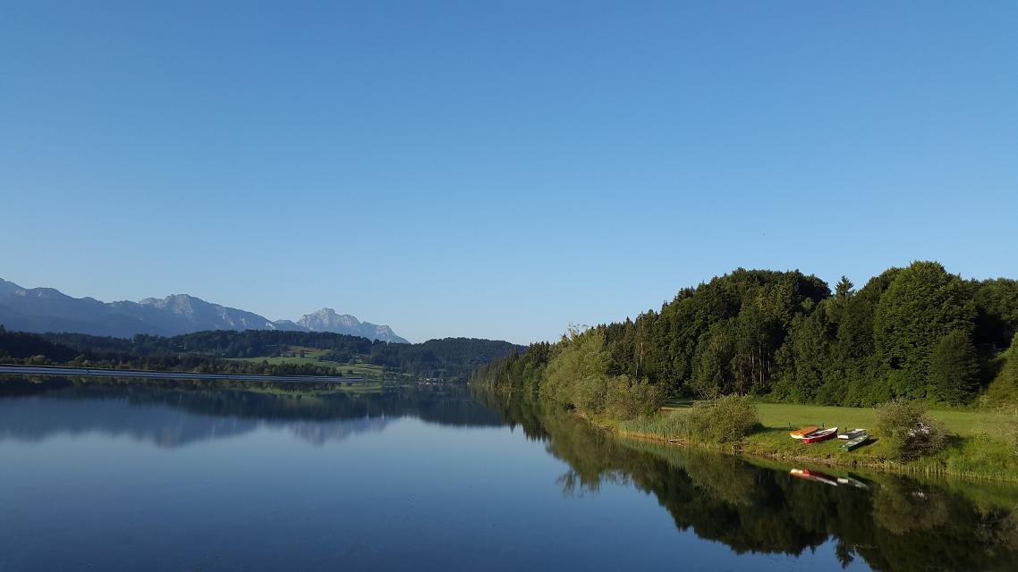
Ausgesprochen aussichtsreich führen uns die größtenteils gut ausgebauten Wege von Steingaden bis auf den Auerberg mit der weithin sichtbaren St. Georgs Kirche. Nachdem wir zunächst noch idyllisch entlang des Urspringer Lechstausees wandern, genießen wir auf dem Weg von Lechbruck in Richtung Auerberg fast durchgehend ein fantastisches Bergpanorama.
5:30 h 493 hm 212 hm 17,9 km sehr schwer

ca. 0,0 km entfernt
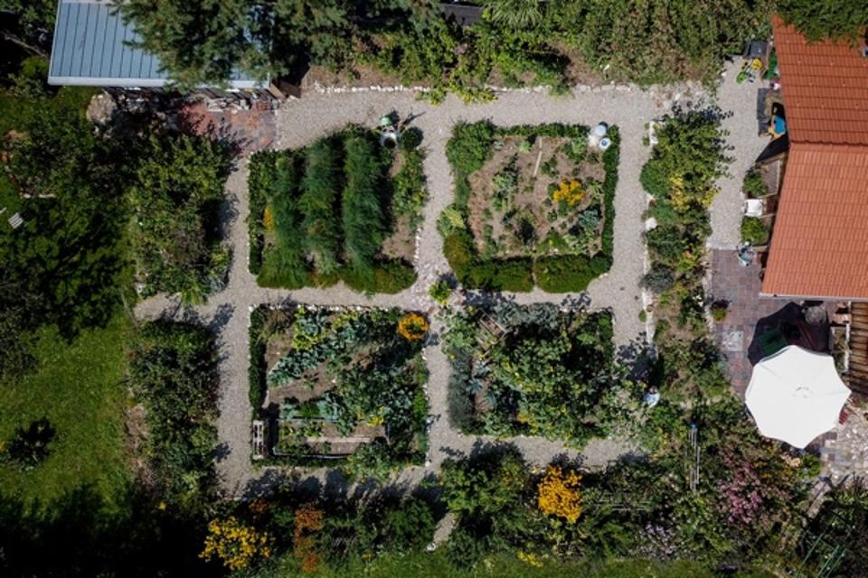
Klostergarten "St. Johannes"
86989 Steingaen, Germany
Ehemaliger Klostergarten, der nach alten Vorbildern innerhalb eines Jahres in ehrenamtlicher Arbeit als Lehr- und Medidationsgarten neu gestaltet worden ist. „Heilung - Ernährung - Spiritualität – Muße“ Diese vier tragenden Säulen traditioneller, klösterlicher Gartenkultur werden in diesem Garten ganzheitlich erlebbar. Sehr gepflegte, botanische und artenreiche Pflanzenwelt Heilpflanzen, Bibelpflanzen, geschützte Pflanzen, Wildblumen, kultivierte Blumen des ländlichen Gartens, usw.


ca. 0,1 km entfernt
Wies-Runde
Schöne Rundtour mit tollem Bergblick zur berühmten Wieskirche.
0:55 h 117 hm 110 hm 11,3 km

ca. 0,1 km entfernt
Panoramarunde Richtung Auerberg
Aussichtsreiche Rundtour Richtung Auerberg
2:45 h 371 hm 371 hm 37,2 km mittel

ca. 0,1 km entfernt
Genussrundtour zur Wieskirche
Abwechslungsreiche Rundtour zur Wieskirche mit herrlichen Ausblicken
1:10 h 122 hm 117 hm 14,9 km mittel

ca. 0,1 km entfernt
Panorama-Runde Schlosspark
Der Name spricht Bände - neben den wunderbaren Ausblicken auf Forggensee, Lech, Schloss Neuschwanstein und die Tannheimer Berge locken entlang dieser Runde auch näherliegende Schönheiten wie die Wieskirche, Badespaß am Illasbergsee oder das Premer Filz. Hier gibt es für alle, die nicht nur gern radeln sondern auch wandern, einen Moorlehrpfad.
3:05 h 300 hm 299 hm 41,3 km mittel

ca. 0,1 km entfernt
Forggenseerunde
Rundtour mit tollen Aussichten und möglichen Badestopps
3:50 h 272 hm 266 hm 53,5 km

ca. 0,1 km entfernt
Lechtour: über Riesen -Burggen zurück nach Steingaden
Abwechslungsreiche Rundtour mit Überquerung der Lechtalbrücke Schongau und interessanten Ausblicken. Besuchen Sie vor der Befahrung der Lechtalbrücke die Villa Rustica in Peiting. Die historische Ausgrabungsstätte eines römischen Landgutes aus dem 2. Jahrhundert n. Chr.
2:25 h 223 hm 223 hm 32,7 km


ca. 0,1 km entfernt
Radrundtour Steingaden-Rottenbuch-Wildsteig
Aussichtsreiche Rundtour von Steingaden über Rottenbuch nach Wildsteig und zurück.
2:55 h 441 hm 335 hm 36,5 km mittel

ca. 0,1 km entfernt
Lauterbach-Rundweg
In Steingaden beginnt der Rundweg nach Lauterbach. Vom Startpunkt führt der Weg über wenig befahrene Sträßchen und Forstwege nordöstlich von Steingaden. Ein Begleiter der Tour ist der grandiose Weitblick auf die Alpen und auf das Welfenmünster. Ausgeschildert ist der Weg mit der Nr. 119, blau.
2:15 h 142 hm 142 hm 7,3 km mittel

ca. 0,1 km entfernt
Osterbichl-Rundweg
Der Osterbichl-Rundweg führt uns durch das wunderschöne Voralpenland, wo Wanderer die sanfte Hügellandschaft östlich von Steingaden durchstreifen. Auf dieser Tour taucht man in den malerischen Brunnhäuslwald ein. Wann immer dieser verlassen wird, bieten sich wunderschöne Blicke auf die Alpen. Beschildert: Nr. 118, grün
1:15 h 118 hm 118 hm 4,6 km mittel

ca. 0,1 km entfernt
Kriegerdenkmal Steingaden
Marktplatz 2, 86989 Steingaden, Germany
Kriegerdenkmal zur Erinnerung gefallener Soldaten im Ersten Weltkrieg.
Das könnte Dir auch gefallen
"Das könnte Dir auch gefallen" überspringen
Auerbergland@venture-Route
Die Erlebnis-Radrunde zu Kultur und Natur um den Auerberg.
9:20 h 1047 hm 997 hm 128,0 km sehr schwer

Himmlisch genießen - Genussradeln rund ums Murnauer Moos
Radfahren und gut Essen - zwei untrennbare miteinander verbundene Begriffe.
6:00 h 654 hm 654 hm 81,1 km sehr schwer


Himmlisch genießen - Genussradeln zwischen Staffelsee und Ammer
Radfahren und gut Essen - zwei untrennbare miteinander verbundene Begriffe.
3:45 h 277 hm 277 hm 54,0 km mittel


Himmlisch genießen - Genussradeln zwischen Staffelsee und Lech
Radfahren und gut Essen - zwei untrennbare miteinander verbundene Begriffe.
6:30 h 779 hm 779 hm 89,5 km mittel


Land der Moore - Radeln zwischen Bad Kohlgrub und Benediktbeuern
Das Alpenvorland zählt zu den faszinierendsten Landschaften Deutschlands, und sogar ganz Europas.
6:20 h 498 hm 498 hm 91,1 km sehr schwer


Lechtour: über Riesen -Burggen zurück nach Steingaden
Abwechslungsreiche Rundtour mit Überquerung der Lechtalbrücke Schongau und interessanten Ausblicken. Besuchen Sie vor der Befahrung der Lechtalbrücke die Villa Rustica in Peiting. Die historische Ausgrabungsstätte eines römischen Landgutes aus dem 2. Jahrhundert n. Chr.
2:25 h 223 hm 223 hm 32,7 km


MuSeenLandschaft Expressionismus: Etappe 1 - Lenbachhaus - Buchheim Museum
Die Tour ist die erste Etappe einer mehrtägigen Rad-Rundtour, die in München am Lenbachhaus startet und dann eine Schleife durch die MuSeenLandschaft über Bernried am Starnberger See, Murnau, Kochel und Penzberg dreht.
4:35 h 246 hm 157 hm 61,2 km


MuSeenLandschaft Expressionismus: Etappe 2 - Buchheim Museum - Schloßmuseum Murnau
Die Tour ist die zweite Etappe einer mehrtägigen Rad-Rundtour, die in München am Lenbachhaus startet und dann eine Schleife durch die MuSeenLandschaft über Bernried am Starnberger See, Murnau, Kochel und Penzberg dreht.
2:10 h 162 hm 62 hm 30,0 km


MuSeenLandschaft Expressionismus: Etappe 3 - Schloßmuseum Murnau - Franz Marc Museum
Die Tour ist die dritte Etappe einer mehrtägigen Rad-Rundtour, die in München am Lenbachhaus startet und dann eine Schleife durch die MuSeenLandschaft über Bernried am Starnberger See, Murnau, Kochel und Penzberg dreht.
3:20 h 275 hm 289 hm 43,2 km


MuSeenLandschaft Expressionismus: Etappe 4 - Franz Marc Museum - Museum Penzberg
Die Tour ist die vierte Etappe einer mehrtägigen Rad-Rundtour, die in München am Lenbachhaus startet und dann eine Schleife durch die MuSeenLandschaft über Bernried am Starnberger See, Murnau, Kochel und Penzberg dreht.
1:25 h 21 hm 52 hm 21,4 km


MuSeenLandschaft Expressionismus: Etappe 5 - Museum Penzberg - Lenbachhaus
Die Tour ist die fünfte und letzte Etappe einer mehrtägigen Rad-Rundtour, die in München am Lenbachhaus startet und dann eine Schleife durch die MuSeenLandschaft über Bernried am Starnberger See, Murnau, Kochel und Penzberg dreht.
6:00 h 203 hm 270 hm 82,4 km


")
Panorama-Runde Schlosspark
Der Name spricht Bände - neben den wunderbaren Ausblicken auf Forggensee, Lech, Schloss Neuschwanstein und die Tannheimer Berge locken entlang dieser Runde auch näherliegende Schönheiten wie die Wieskirche, Badespaß am Illasbergsee oder das Premer Filz. Hier gibt es für alle, die nicht nur gern radeln sondern auch wandern, einen Moorlehrpfad.
3:05 h 300 hm 299 hm 41,3 km mittel


Radpilgern durch Pfaffenwinkel und Zugspitz Region: Weitblicke - Vom Hohen Peißenberg zu spiegelnden Wassern
Diese Runde ist der Himmel. Ihm kommt man ganz nah auf dem Hohen Peißenberg mit seiner über 500 Jahre alten Wallfahrtskirche und einem der schönsten Rundblicke Bayerns.
7:00 h 931 hm 931 hm 94,9 km

Radpilgern durch Pfaffenwinkel und Zugspitz Region: Wilde Flüsse - zwischen Auerberg und Hohem Peißenberg
Diese Runde vereint alles, was den Pfaffenwinkel so anziehend macht: Barocke Pracht und ländliches Leben, Wege nach innen und atemberaubende Fernblicke, Kulturland mit Geschichte und nahezu unberührte Natur.
7:25 h 1004 hm 1004 hm 98,2 km