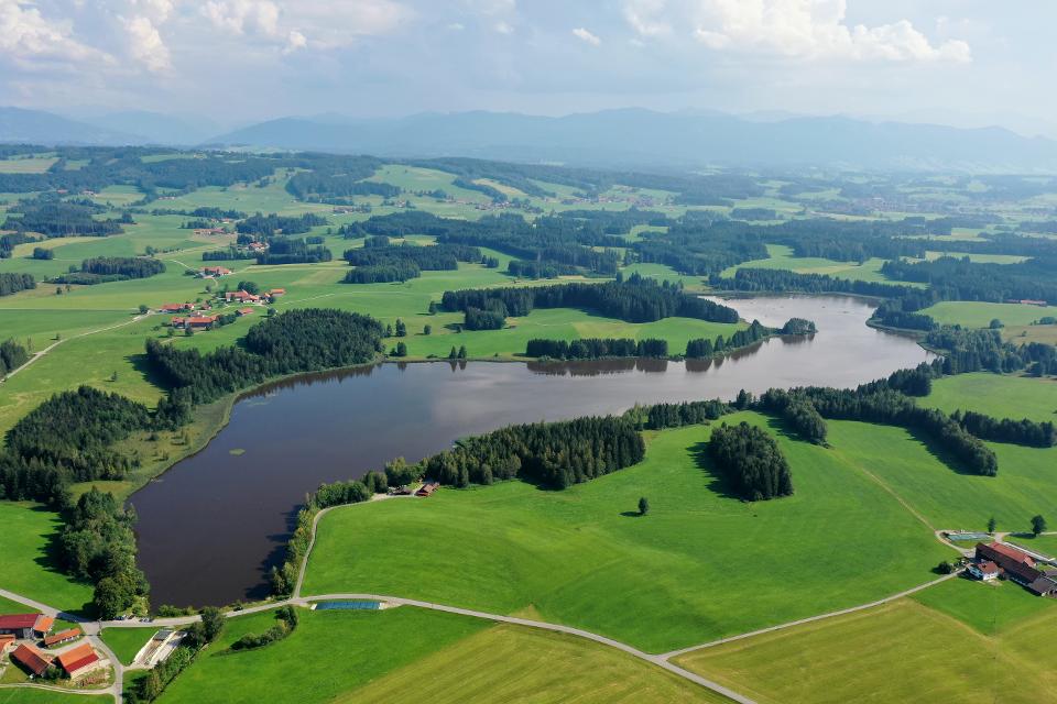
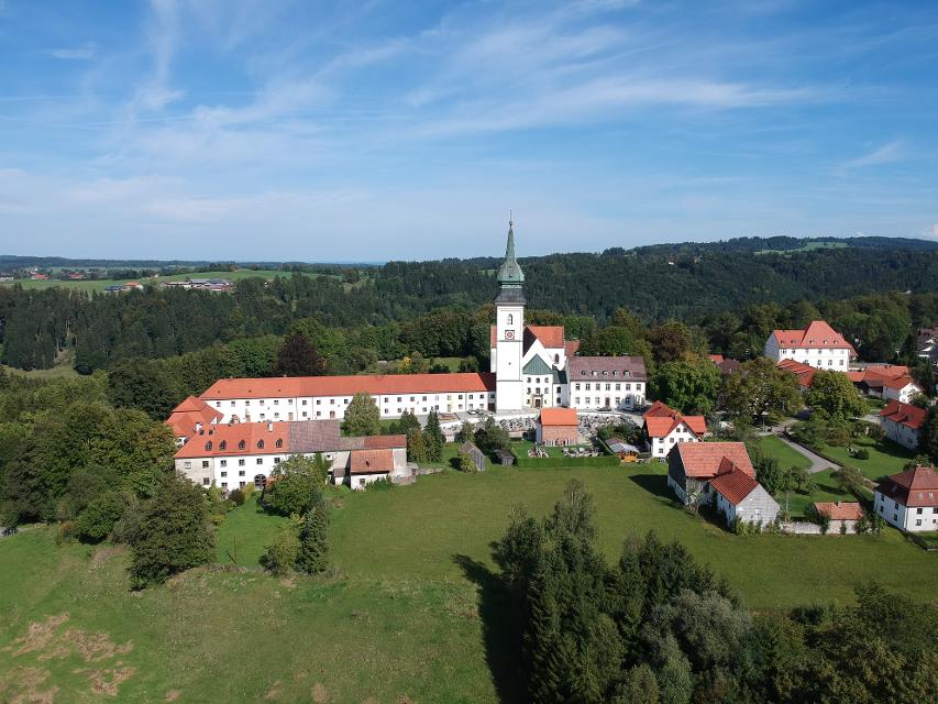

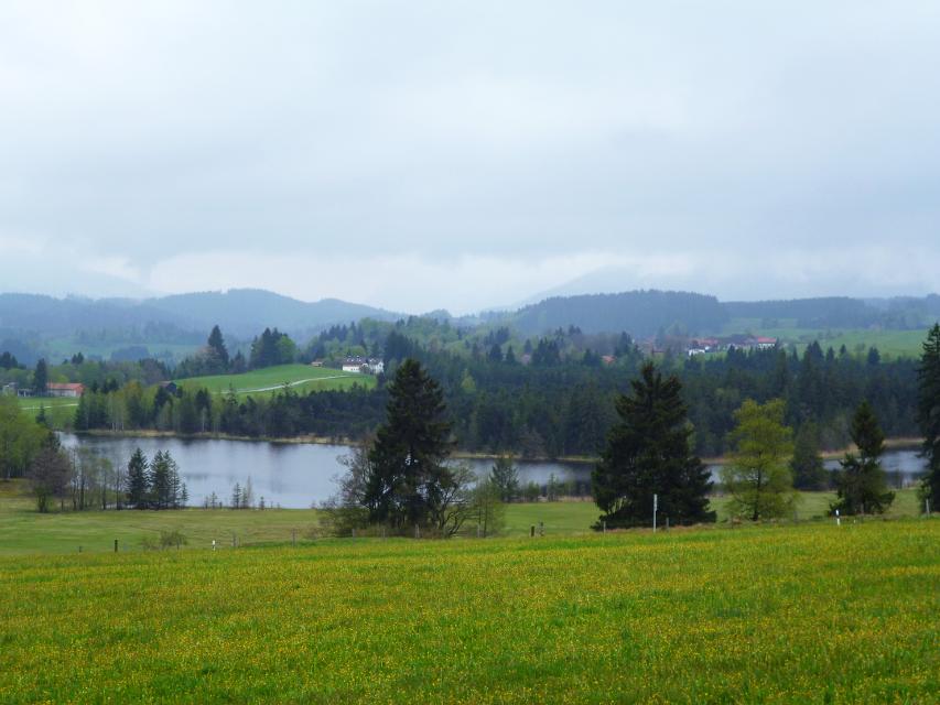
Der Genussort Peiting ist ein idealer Startpunkt für diese Schleife, die zwischen den beiden Flüssen Lech im Westen und der Ammer im Osten verläuft.
-
Aufstieg: 311 hm
-
Abstieg: 311 hm
-
Länge der Tour: 42,0 km
-
Höchster Punkt: 878 m
-
Differenz: 167 hm
-
Niedrigster Punkt: 711 m
Saisonale Eignung
-
JAN
-
FEB
-
MRZ
-
APR
-
MAI
-
JUN
-
JUL
-
AUG
-
SEP
-
OKT
-
NOV
-
DEZ
<p>Kostenloser Parkplatz an der ehemaligen Mädchenschule Bachstr. 4.</p> <p>Alternativ: Kostenloser Parkplatz am Sportgelände Alfons-Peter-Straße</p>


Hier befindet sich auch


Gaststätte Moser
Wies 1, 86989 Steingaden, Germany
Öffnungszeiten: Täglich von 9.oo bis 19.oo Uhr Warme Küche von 11.3o bis 17.oo Uhr Mittwoch Ruhetag

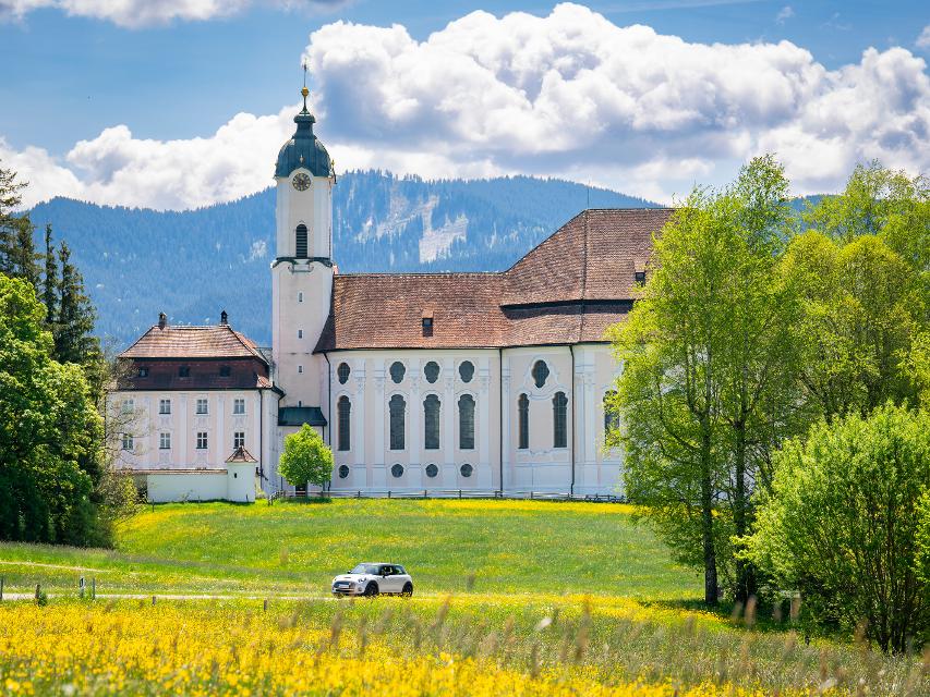
Wallfahrtskirche zum Gegeißelten Heiland auf der Wies
Wies 12, 86989 Steingaden, Germany
Die Wieskirche bei Steingaden ist eine der berühmtesten Rokokokirchen der Welt. Seit 1983 ist die Wieskirche UNESCO-Welterbestätte. Die Mitte dieses Gotteshauses ist die Figur des leidenden Christus, des Gegeißelten Heilandes.


Fischerhaus Steingaden mit Schönegger Käse-Alm
Füssenerstraße 27, 86989 Steingaden, Germany


Tourist Information Steingaden
Krankenhausstraße 2, 86899 Steingaden, Germany
Herzlich Willkommen in Steingaden!


Wellenfreibad Peiting
Ammergauer Str. 20 a, 86971 Peiting, Germany
Besuchen Sie das beliebte und beheizte Wellenfreibad im Herzen von Peiting. Erleben Sie stündlich die Wellen im großen Wellenbecken oder plantschen Sie im erhöht gelegenen Nichtschwimmerbecken mit Rutsche und Wasserspielelandschaft. Werden Sie aktiv am Beachvolleyballplatz oder relaxen im Tropical Hangout. Für Kinder ist das Kinderplantschbecken sowie das Klettergerüst am Kinderspielplatz zu empfehlen. In der Nähe des Eingangsbereichs wurde ein Boule-Platz neu gestaltet. Besonders hervorzuheben ist die große Spiel- und Liegewiese in der weitläufigen Grünanlage. Sie sorgt dafür, dass die Besucher genügend Privatsphäre haben. Im Kiosk mit Außenbereich werden Sie immer gerne bedient.
Essen in der Nähe
"Essen in der Nähe" überspringen
ca. 0,1 km entfernt
Hotel-Restaurant „Zum Dragoner“ OHG
Ammergauer Str. 11 + 16, 86971 Peiting, Deutschland


ca. 0,8 km entfernt
Bäckerei & Café Sesar
Bahnhofstraße 21, 86971 Peiting, Germany
Handwerklich-traditionelle Backkunst aus Peiting.

ca. 2,6 km entfernt
Lagerhaus
Karmeliterstr. 5, 86956 Schongau, Germany
Restaurant, mit Cafe und Bar. Seit dem Umbau kann das Lagerhasu auch mit einem Kinobesuch der besonderen Art aufwarten.

ca. 2,8 km entfernt

ca. 3,1 km entfernt
Herzog Cafe und Wirtshaus in Herzogsägmühle
Dorfplatz 8, 86971 Peiting-Herzogsägmühle, Germany
Das Café Herzog ist das öffentliche Café und Wirtshaus in Herzogsägmühle, mit Spielplatz, Minigolf und zwei Kegelbahnen. Unsere Speisekarte ist klein, aber fein. Wo immer möglich, verarbeiten wir regionale und nachhaltig erzeugte Produkte – selbstverständlich auch aus Herzogsägmühler Betrieben wie der Metzgerei, der Bäckerei sowie der Gärtnerei.Ebenso stellen wir viele Produkte hausgemacht her – wir haben Freude daran und hoffen, Sie mit unseren Speisen ein wenig verwöhnen zu können.Wir bieten Frühstück, Mittagessen und am Nachmittag können Sie sich auf erfrischende Eisbecher sowie hausgemachten Kuchen freuen. Unser barrierefreies Restaurant wurde mehrfach für seinen kinder- und familienfreundlichen Service ausgezeichnet.
ca. 4,7 km entfernt
Schreinercafé
Friedhofweg 9, 86972 Altenstadt, Germany
Wer im Schreinercafé sitzt, genießt von der Frau des Schreinermeisters Richard Kögl täglich frisch gebackenen Kuchen , frisch gebrühten Kaffee wie er schon einst von Oma zubereitet wurde, und einen unverstellten Blick auf die romanische Basilika unweit des Cafés


ca. 6,8 km entfernt
Gaststätte Bayerischer Rigi
M. Günther-Pl. 2, 82383 Hohenpeißenberg, Germany
Schweinshaxe, Jägerbraten und Staffelseezander im zünftigen Wirtshaus mit Panoramaterrasse auf 1000 m Höhe.


ca. 7,4 km entfernt
Restaurant Zauberhütte
Mößle 2, 86971 Peiting, Germany
Idyllisch und ruhig gelegen inmitten von Wiesen mit traumhaften Ausblick auf das Alpenpanorama.

ca. 8,4 km entfernt
Hofcafä Burggen
Ziegler 2, 86977 Burggen, Germany
Das ist ja cool! Das ist meist die erste Reaktion von Radlern und Wanderern, die „zufällig“ amHofcafä vorbeikommen. Da steht ein Bauwagen mit herrlich einladenden Tischen und Sonnenschirmenam Hof. Und im Bauwagen? Selbstbedienung. Und zwar nur vom Feinsten!
Unterkünfte in der Nähe
"Unterkünfte in der Nähe" überspringen
ca. 0,1 km entfernt
Hotel-Restaurant „Zum Dragoner“ OHG
Ammergauer Str. 11 + 16, 86971 Peiting, Deutschland


ca. 0,2 km entfernt
Wohnmobilstellplatz Peiting
Ammergauer Straße 20a, 86972 Peiting, Germany
Sie finden fünf idyllisch, zentral und dennoch ruhig gelegene Wohnmobilstellplätze am Parkplatz neben dem Wellenfreibad.


Weitere Tipps in der Nähe
"Weitere Tipps in der Nähe" überspringen
ca. 0,1 km entfernt
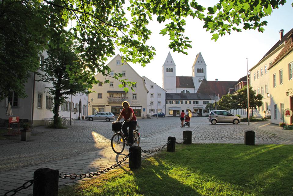
Pfarrkirche St. Michael
Hauptplatz 21, 86971 Peiting, Germany
Die Pfarrkirche St. Michael ist tagsüber für Besucher geöffnet.

ca. 0,1 km entfernt
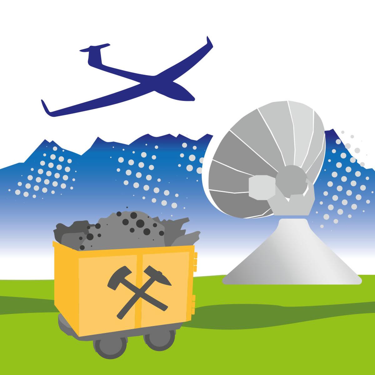
Bergwerkstour
Diese Radtour führt durch lauter ehemalige Bergbauorte. Alle drei Orte verfügten über ein Kohlebergwerk und wurden dadurch jahrzehntelange geprägt. Mittelschwere Tour mit längerem Anstieg von Peißenberg zurück nach Hohenpeißenberg. In Hohenpeißenberg bietet sich ein herrlich Blick auf die Alpenkette. Der Abstecher auf den Bayerischen Rigi ist empfehlenswert.
2:00 h 281 hm 281 hm 27,1 km mittel


ca. 0,1 km entfernt
Tourist-Information Peiting
Hauptplatz 4, 86971 Peiting, Germany
Direkt am Hauptplatz neben dem Barbarabrunnen finden Sie unsere Tourist-Information.

ca. 0,2 km entfernt
Peitnachrunde
Die Tour führt von Peiting zum Kalvarienberg und an der Peitnach entlang. Eine malerische Runde mit Alpenblick und Sicht auf den Hohen Peißenberg. Vor allem für Familien mit Kindern ist der Walderlebnispfad auf dem Kalvarienberg ein spannendes Erlebnis. Beschildert: Nr. 100, grün
2:00 h 147 hm 149 hm 6,4 km mittel
ca. 0,2 km entfernt
Wellenfreibad Peiting
Ammergauer Str. 20 a, 86971 Peiting, Germany
Besuchen Sie das beliebte und beheizte Wellenfreibad im Herzen von Peiting. Erleben Sie stündlich die Wellen im großen Wellenbecken oder plantschen Sie im erhöht gelegenen Nichtschwimmerbecken mit Rutsche und Wasserspielelandschaft. Werden Sie aktiv am Beachvolleyballplatz oder relaxen im Tropical Hangout. Für Kinder ist das Kinderplantschbecken sowie das Klettergerüst am Kinderspielplatz zu empfehlen. In der Nähe des Eingangsbereichs wurde ein Boule-Platz neu gestaltet. Besonders hervorzuheben ist die große Spiel- und Liegewiese in der weitläufigen Grünanlage. Sie sorgt dafür, dass die Besucher genügend Privatsphäre haben. Im Kiosk mit Außenbereich werden Sie immer gerne bedient.


ca. 0,3 km entfernt
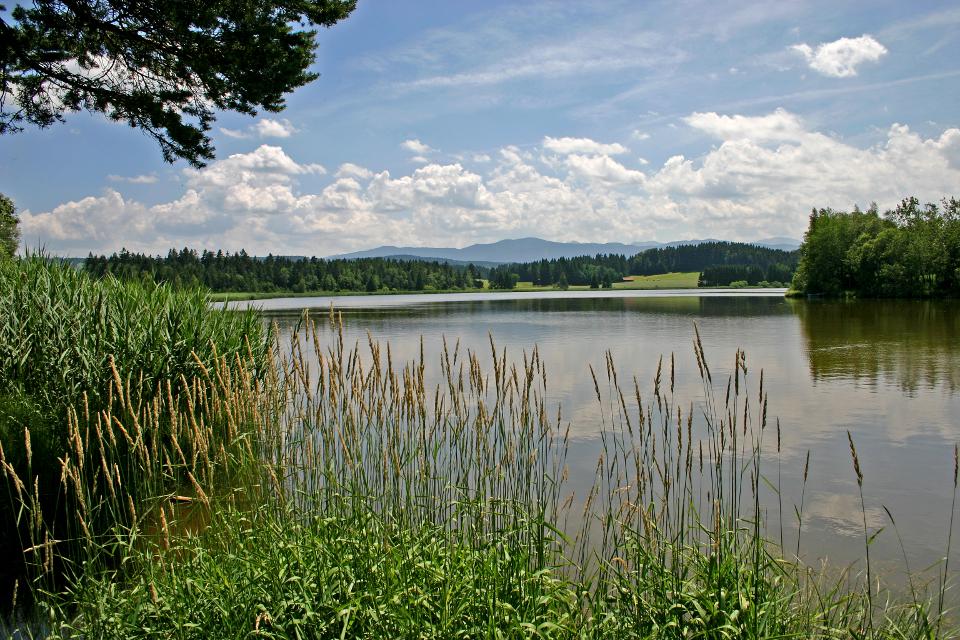
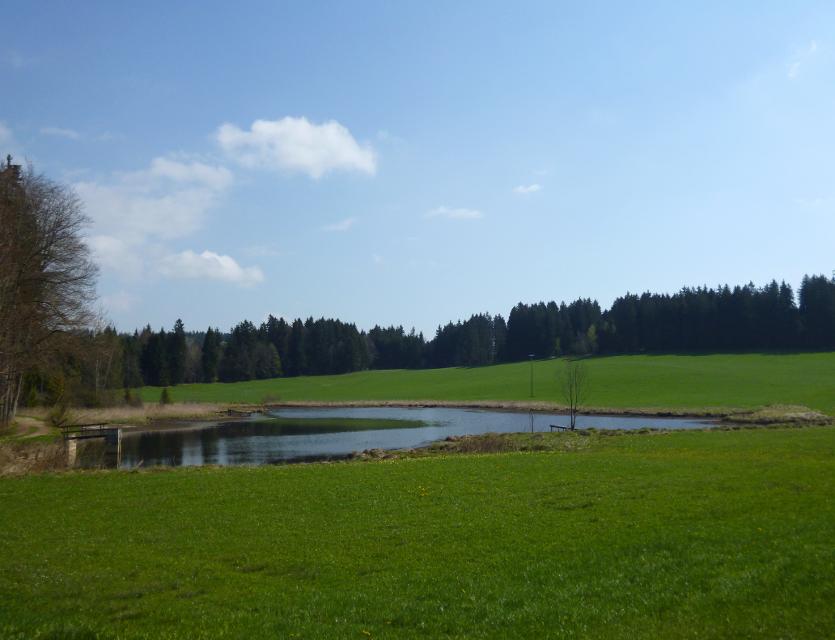
Dorfweiher Gumpen in Peiting
Gumpenweg, 86971 Peiting, Germany
Der Dorfweiher Gumpen – gespeist vom Wasser der Peitnach – finden Sie im Herzen der Marktgemeinde. Er ist ein Naturidyll und Heimat für verschiedene Wasservögel. Ein gemütlicher Spazierweg führt rund um diesen kleinen „See“, indem sich sogar eine Biberfamilie wohl fühlt. Auch im Winter ist der Weg um den Gumpen zu empfehlen.

ca. 0,3 km entfernt
Lourdes-Grotte
Grottenweg, 86971 Peiting, Germany
Als originalgetreue Nachbildung der berühmten Grotte in Lourdes wurde sie im Jahr 1896 durch H.H. Pfarrer Braun von der Pfarrgemeinde Peiting erbaut und ist seitdem insbesondere zur Fastenzeit und an Allerheiligen Ausgangspunkt des Kreuzweges auf den Kalvarienberg. Der Verschönerungsverein Peiting pflegt und erhält dieses religiöse Bauwerk.

ca. 0,5 km entfernt
Römer und Welfen am Lech - Peiting
Auf dem bergigen Rundweg zwischen Schongau und Peiting folgt ein Highlight dem anderen. Am Schlossberg und an der Villa Rustica wandeln Wanderer auf den Spuren von Römern und Welfen, auf dem Walderlebnispfad warten spannende Stationen zum Mitmachen auf große und kleine Besucher und dazwischen eröffnen sich immer wieder grandiose Blicke auf die Alpenkette und den türkis leuchtenden Lech.
4:00 h 359 hm 359 hm 13,7 km mittel

ca. 0,5 km entfernt
Beachvolleyballplatz im Wellenfreibad Peiting
Ammergauer Straße 20a, 86971 Peiting, Germany
Während der Öffnungszeiten des Wellenfreibades Peiting kann der Beachvolleyballplatz genutzt werden.

Das könnte Dir auch gefallen
"Das könnte Dir auch gefallen" überspringen
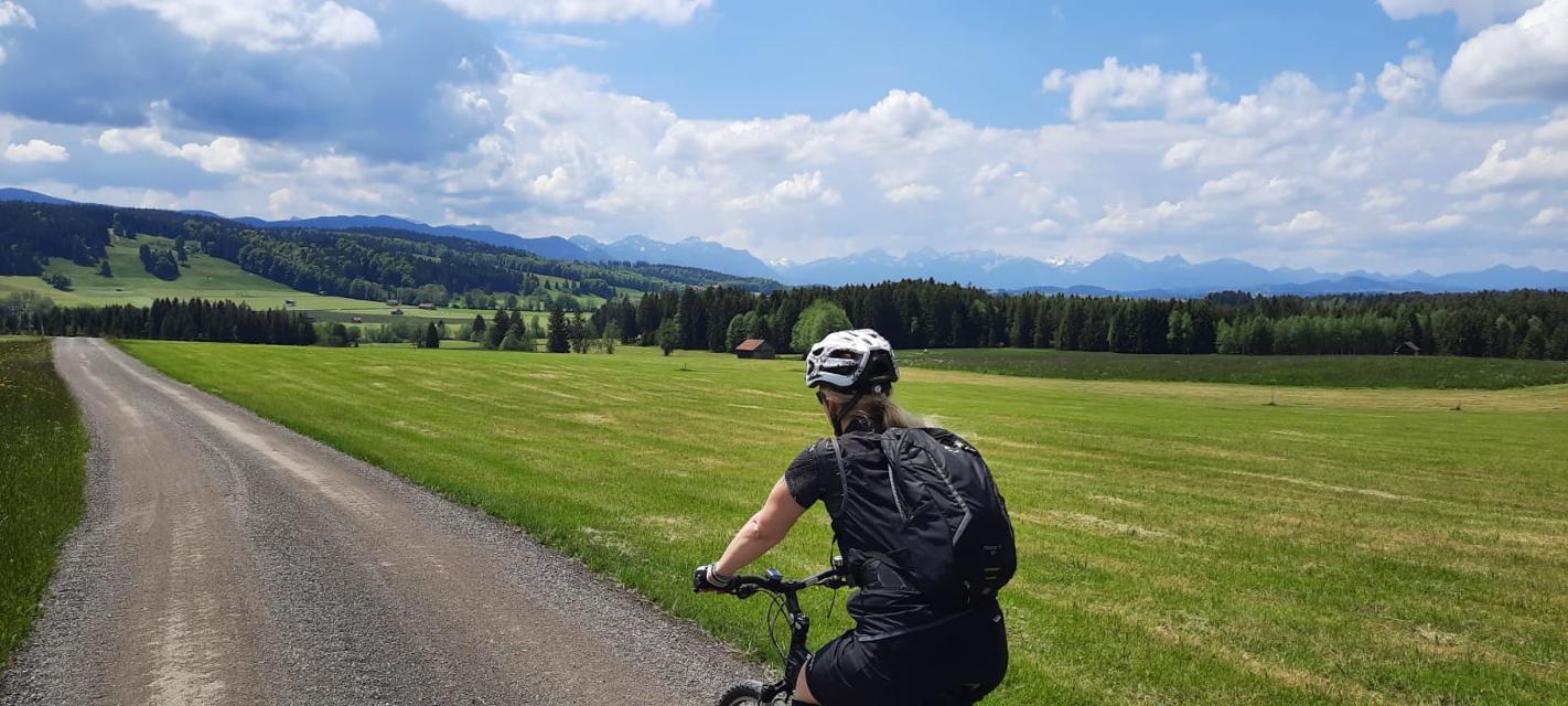
Auerbergland@venture-Route
Die Erlebnis-Radrunde zu Kultur und Natur um den Auerberg.
9:20 h 1047 hm 997 hm 128,0 km sehr schwer

Himmlisch genießen - Genussradeln rund ums Murnauer Moos
Radfahren und gut Essen - zwei untrennbare miteinander verbundene Begriffe.
6:00 h 654 hm 654 hm 81,1 km sehr schwer


Himmlisch genießen - Genussradeln zwischen Staffelsee und Ammer
Radfahren und gut Essen - zwei untrennbare miteinander verbundene Begriffe.
3:45 h 277 hm 277 hm 54,0 km mittel


Himmlisch genießen - Genussradeln zwischen Staffelsee und Lech
Radfahren und gut Essen - zwei untrennbare miteinander verbundene Begriffe.
6:30 h 779 hm 779 hm 89,5 km mittel


Land der Moore - Radeln zwischen Bad Kohlgrub und Benediktbeuern
Das Alpenvorland zählt zu den faszinierendsten Landschaften Deutschlands, und sogar ganz Europas.
6:20 h 498 hm 498 hm 91,1 km sehr schwer


Land der Moore: Radeln rund ums Wiesfilz
Die Schleife führt Radler durch die südwestlichste Ecke des Pfaffenwinkels.
2:15 h 211 hm 211 hm 30,2 km

Lechtour: über Riesen -Burggen zurück nach Steingaden
Abwechslungsreiche Rundtour mit Überquerung der Lechtalbrücke Schongau und interessanten Ausblicken. Besuchen Sie vor der Befahrung der Lechtalbrücke die Villa Rustica in Peiting. Die historische Ausgrabungsstätte eines römischen Landgutes aus dem 2. Jahrhundert n. Chr.
2:25 h 223 hm 223 hm 32,7 km


MuSeenLandschaft Expressionismus: Etappe 1 - Lenbachhaus - Buchheim Museum
Die Tour ist die erste Etappe einer mehrtägigen Rad-Rundtour, die in München am Lenbachhaus startet und dann eine Schleife durch die MuSeenLandschaft über Bernried am Starnberger See, Murnau, Kochel und Penzberg dreht.
4:35 h 246 hm 157 hm 61,2 km


MuSeenLandschaft Expressionismus: Etappe 2 - Buchheim Museum - Schloßmuseum Murnau
Die Tour ist die zweite Etappe einer mehrtägigen Rad-Rundtour, die in München am Lenbachhaus startet und dann eine Schleife durch die MuSeenLandschaft über Bernried am Starnberger See, Murnau, Kochel und Penzberg dreht.
2:10 h 162 hm 62 hm 30,0 km


MuSeenLandschaft Expressionismus: Etappe 3 - Schloßmuseum Murnau - Franz Marc Museum
Die Tour ist die dritte Etappe einer mehrtägigen Rad-Rundtour, die in München am Lenbachhaus startet und dann eine Schleife durch die MuSeenLandschaft über Bernried am Starnberger See, Murnau, Kochel und Penzberg dreht.
3:20 h 275 hm 289 hm 43,2 km


MuSeenLandschaft Expressionismus: Etappe 4 - Franz Marc Museum - Museum Penzberg
Die Tour ist die vierte Etappe einer mehrtägigen Rad-Rundtour, die in München am Lenbachhaus startet und dann eine Schleife durch die MuSeenLandschaft über Bernried am Starnberger See, Murnau, Kochel und Penzberg dreht.
1:25 h 21 hm 52 hm 21,4 km


MuSeenLandschaft Expressionismus: Etappe 5 - Museum Penzberg - Lenbachhaus
Die Tour ist die fünfte und letzte Etappe einer mehrtägigen Rad-Rundtour, die in München am Lenbachhaus startet und dann eine Schleife durch die MuSeenLandschaft über Bernried am Starnberger See, Murnau, Kochel und Penzberg dreht.
6:00 h 203 hm 270 hm 82,4 km


")

Panorama-Runde Schlosspark
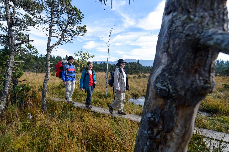
Der Name spricht Bände - neben den wunderbaren Ausblicken auf Forggensee, Lech, Schloss Neuschwanstein und die Tannheimer Berge locken entlang dieser Runde auch näherliegende Schönheiten wie die Wieskirche, Badespaß am Illasbergsee oder das Premer Filz. Hier gibt es für alle, die nicht nur gern radeln sondern auch wandern, einen Moorlehrpfad.
3:05 h 300 hm 299 hm 41,3 km mittel


Radpilgern durch Pfaffenwinkel und Zugspitz Region: Weitblicke - Vom Hohen Peißenberg zu spiegelnden Wassern
Diese Runde ist der Himmel. Ihm kommt man ganz nah auf dem Hohen Peißenberg mit seiner über 500 Jahre alten Wallfahrtskirche und einem der schönsten Rundblicke Bayerns.
7:00 h 931 hm 931 hm 94,9 km

Radpilgern durch Pfaffenwinkel und Zugspitz Region: Wilde Flüsse - zwischen Auerberg und Hohem Peißenberg
Diese Runde vereint alles, was den Pfaffenwinkel so anziehend macht: Barocke Pracht und ländliches Leben, Wege nach innen und atemberaubende Fernblicke, Kulturland mit Geschichte und nahezu unberührte Natur.
7:25 h 1004 hm 1004 hm 98,2 km