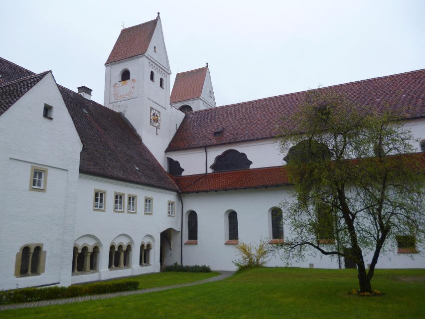
4-Flüsse-Tour - Ammer, Lech, Loisach, Isar (2 Tage)
9:25 h 1600 hm 1216 hm 162,8 km mittel


-
Aufstieg: 1600 hm
-
Abstieg: 1216 hm
-
Länge der Tour: 162,8 km
-
Höchster Punkt: 990 m
-
Differenz: 442 hm
-
Niedrigster Punkt: 548 m
Schwierigkeit
mittel
Kondition
mittel
Panoramablick
mittel
Saisonale Eignung
-
JAN
-
FEB
-
MRZ
-
APR
-
MAI
-
JUN
-
JUL
-
AUG
-
SEP
-
OKT
-
NOV
-
DEZ
Merkmale Touren
Aussichtsreich
Geologische Highlights
Einkehrmöglichkeit
Botanische Highlights
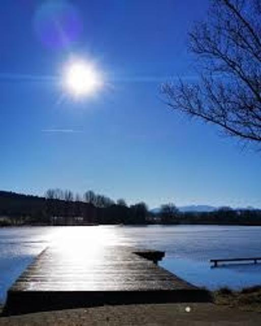
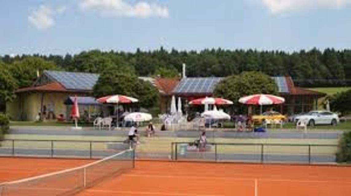
<p>Am Dietlhofer See in Weilheim</p>


Hier befindet sich auch


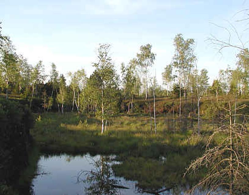
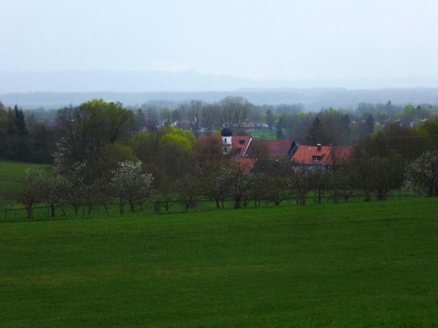
Premer Filz
86984 Prem, Germany
Eine interessante Wanderung durch den Moorlehrpfad mit herrlichem Ausblick auf das Moor. Der Moorlehrpfad ist eine interessante Wanderung mit herrlichem Ein- und Ausblicken auf das Premer Filz. Die Wanderung führt über den Moorlehrpfad, an dem auf Informationstafeln viel Wissenswerte über das Premer Filz zu erfahren ist. Wunderschöne Einblicke in das Moor geben der Wanderung ihren Reiz.

Essen in der Nähe
"Essen in der Nähe" überspringen
ca. 0,5 km entfernt
Caro‘s Gutscafé & Hofladen
Dietlhofen 1, 82362 Weilheim, Germany
„Lass uns heute Kaffee trinken und im Hofladen ein Bisonfell kaufen.“ Na klar, das geht hier in Caros Gutscafe auf Gut Dietlhofen.

ca. 0,9 km entfernt
Hofgarten Pfaffenwinkel
Dorfstraße 4, 823662 Weilheim - Unterhausen, Germany
Auf einem besonders schönen Flecken Erde befindet sich der Hofgarten Pfaffenwinkel mit seinem idyllischen Café.

ca. 1,8 km entfernt
Gelateria und Pizzeria Emporio
Schmidstraße 20, 82362 Weilheim, Germany
Ob auf einen schnellen Espresso oder einen gemütlichen Cappuccino mit italienischen Leckereien, hier ist jeder herzlich willkommen! Probieren Sie auch Eis und Patisserieprodukte aus eigener Herstellung. Und für den etwas größeren Hunger wartet traditionell mediterrane italienische Küche auf die Besucher.

ca. 1,9 km entfernt
Tapas-Bar Torito
Admiral-Hipper-Str. 18, 82362 Weilheim, Germany
Herzlich Willkommen im Torito – TAPAS Y MAS! Im „Kleinen Stier“ gibt es Tapas und mehr! Bis 19 Uhr gibt es eine kleine Tapa zu jedem Getränk.

ca. 2,0 km entfernt
Gasthof Allgäuer Hof
Marienplatz 17, 82362 Weilheim, Germany
Der Allgäuer Hof ist eine traditionelle bayrische Gaststätte im Zentrum Weilheims (in Oberbayern).


ca. 2,0 km entfernt
Restaurant La Ruota
Kreuzgasse 10, 82362 Weilheim, Germany
Lassen Sie sich verwöhnen und genießen Sie Ihre Auszeit in Weilheim im Restaurant La Ruota.
ca. 2,0 km entfernt
Restaurant Korfu
Kreuzgasse 7, 82362 Weilheim, Germany
Griechisches Restaurant mit Biergarten in der Weilheimer Innenstadt.

ca. 2,0 km entfernt

ca. 2,3 km entfernt
Hotel Restaurant Pöltner Hof Weilheim
Pollinger Str. 4 & 6, 82362 Weilheim in Oberbayern, Germany
Die zentrale Lage im Zentrum von Weilheim und die schmackhafte Küche lockt Gäste von Nah und Fern in unser Restaurant. Reservieren Sie Ihren Tisch online.


ca. 3,5 km entfernt
Gartencafé Wieshof
Wieshof 1, 82362 Weilheim-Marnbach, Germany
Idyllisch inmitten der Natur lädt eine Oase der Ruhe zum Verweilen ein. Kaffee und selbst gebackener Kuchen kann inmitten des Gartens genossen werden...

ca. 3,6 km entfernt
Trifthofstüberl
Trifthofstr. 57, 82362 Weilheim, Germany
In diesem gemütlichen und rustikalen Lokal wird Ihnen gutbürgerliche Küche serviert. In zwei getrennten Räumen ist Platz für bis zu 50 Personen. Am separaten Imbiss im separaten vorderen Bereich können Sie täglich (ausser Wochenende) ab 7.00-14:00 Uhr frisch zubereitete Speisen mitehmen.
Unterkünfte in der Nähe
"Unterkünfte in der Nähe" überspringen


ca. 2,2 km entfernt
Wohnmobilstellplatz Weilheim
Lohgasse 17, 82362 Weilheim, Germany
Hinweis: im Ort den Reisemobil-Piktogrammen zum Stellplatz folgenGPS-Koordinaten: N 47° 84‘ 00" / O 11° 13‘ 63"Der In weniger als 500 Meter Entfernung vom Wohnmobilstellplatz befinden sich: Ufer der Ammer mit Fuß- und Radweg nach Norden und Süden Naherholungsgebiet „Au“ mit neu angelegtem Fitness-Parcours für Jung und Alt Weilheims historische Altstadt mit zahlreichen Einkaufs- und Einkehrmöglichkeiten Lebensmittel-Discounter in der Lohgasse


ca. 2,6 km entfernt
Ferienwohnung Elisabeth
Wettersteinstraße 8, 82362 Weilheim i. OB, Deutschland


ca. 9,1 km entfernt
Weitere Tipps in der Nähe
"Weitere Tipps in der Nähe" überspringen
ca. 0,0 km entfernt
Alpenblick-Tour
Der Name ist Programm: Auf der ersten Hälfte dieser abwechslungsreichen Fahrt hat man stets die Alpenkette im Blick
5:20 h 770 hm 767 hm 96,5 km sehr schwer


ca. 0,4 km entfernt
Hoppolino Kinderland - Weilheim
Münchener Str. 67a, 82362 Weilheim, Germany
Mach Deine Geburtstagsfeier zu einem unvergesslichen Erlebnis für Dich und Deine Freunde. Hier machen wir eine coole Party. Und das Allerbeste: Bei jedem Wetter! In meinem Bistro gibt‘s superleckere Menüs, wenn Du vom Herumtollen hungrig uDein Hoppolino.

ca. 0,5 km entfernt
Hardtrunde (mittel)
Die landschaftlich reizvolle Hardtrunde führt in ihrem östlichen Teil durch die wunderschöne, äußerst vielfältige Hardtlandschaft. Saftig grüne Wiesen wechseln sich immer wieder mit weitläufigen Wald- und Moorgebieten ab. Im Gegensatz dazu ist der westliche Teil der Runde geprägt durch die weiten, häufig landwirtschaftlich genutzten Felder und Wiesen rund um den Dietlhofer See, der sich im Sommer hervorragend zum Baden eignet. Beschildert: Nr. 43, blau
2:00 h 88 hm 88 hm 7,1 km sehr leicht
")
ca. 0,5 km entfernt
Hardtrunde (lang)
Die ausgedehnte Runde führt über weite Strecken durch die einzigartige Hardtlandschaft mit Hoch- und Niedermooren, Magerrasen- und Streuwiesengebieten sowie weitläufigen Wäldern. Auf dem landschaftlich äußerst reizvollen Weg über kaum befahrene Sträßchen und ruhige Forstwege genießen Spaziergänger immer wieder traumhafte Ausblicke auf die Alpenkette. Beschildert: Nr. 44, rot
2:30 h 109 hm 109 hm 9,6 km mittel
")
ca. 0,5 km entfernt
Hardtrunde (kurz)
Die kurze Version der Hardtrunde streift die typische Hardtlandschaft östlich von Weilheim nur am Rande. Im Zentrum steht vielmehr das sanfte Hügelland rund um den idyllischen Dietlhofer See, einem beliebten Badesee im Norden von Weilheim. Immer wieder genießen Spaziergänger wunderschöne Ausblicke auf den See und den Weiler Dietlhofen. Beschildert: Nr. 42, grün
1:00 h 47 hm 47 hm 3,9 km sehr leicht

ca. 0,5 km entfernt
Winterwanderung - Hardtrunde (kurz)
Die kurze Version der Hardtrunde streift die typische Hardtlandschaft östlich von Weilheim nur am Rande. Im Zentrum steht vielmehr das sanfte Hügelland rund um den idyllischen Dietlhofer See, einem beliebten See zum Baden und Schlittschuhlaufen im Norden von Weilheim. Immer wieder genießen Spaziergänger wunderschöne Ausblicke auf den See und den Weiler Dietlhofen. Beschildert: Nr. 42, grün
1:30 h 33 hm 33 hm 4,0 km sehr leicht
ca. 0,7 km entfernt
SB-Servicestation für Radler an der Berufsschule in Weilheim
Narbonner Ring, 82362 Weilheim in Oberbayern
Ein Plattfuß bei einer Radtour – für viele kein Problem. Für andere dagegen ein traumatisches Erlebnis, vor allem wenn kein Werkzeug zur Hand ist. Schnelle Hilfe verspricht die SB-Radreparaturstation.


ca. 0,7 km entfernt


ca. 1,0 km entfernt
Kutschfahrten Weilheim
Im Kirchwinkel 4, 82362 Weilheim, Germany
Exklusive Kutschfahrten mit erfahrenen Kutschern durch und um Weilheim.
Das könnte Dir auch gefallen
"Das könnte Dir auch gefallen" überspringen
2-Seen-Tour - Staffelsee-Lechsee
Der Staffelsee hat beim Kampf um den Rang des schönsten Voralpensees gute Chancen auf einen Spitzenplatz.
5:30 h 872 hm 840 hm 95,9 km mittel

Alpenblick-Tour
Der Name ist Programm: Auf der ersten Hälfte dieser abwechslungsreichen Fahrt hat man stets die Alpenkette im Blick
5:20 h 770 hm 767 hm 96,5 km sehr schwer

Bayerische Wallfahrt
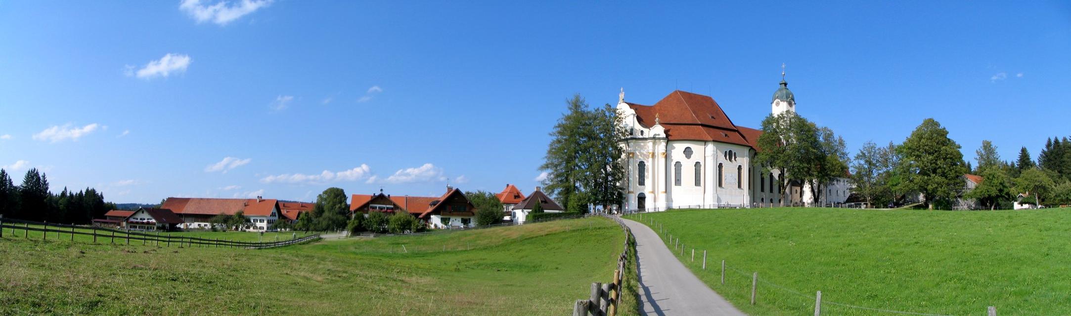
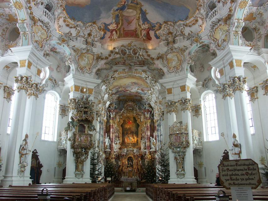
Wallfahren mit dem Rennrad? Warum nicht, auch wenn in diesem Fall die Wieskirche nicht das Endziel der Fahrt ist.
6:30 h 908 hm 907 hm 113,3 km mittel

Pfaffenwinkel-Panorama-Tour
Mit 988 Metern Höhe markiert der Hohe Peißenberg den schönsten Aussichtspunkt im Pfaffenwinkel.
6:55 h 1386 hm 1386 hm 123,0 km sehr schwer


Pfaffenwinkel Radrundfahrt, 160 km
Wir verlassen Peiting in Richtung Schongau. Vorbei an Altenstadt, Sachsenried, Rettenbach, Bernbeuren und dem Auerberg erreicht man Lechbruck. Weiter geht es über Prem, die Wieskirche nach Rottenbuch. Im weiteren Verlauf führt die Route über Schöffau und den Staffelsee wieder Richtung Norden nach Weilheim. Weiter in östliche Richtung erreicht man den Zellsee, Forst und Herzogsägmühle wieder den Ausgangspunkt Peiting.
10:25 h 1235 hm 1241 hm 145,3 km sehr schwer


Eibenwaldrunde
Die gemütliche Tour führt westlich von Weilheim bis zum Paterzeller Eibenwald und über Zellsee wieder zurück.
2:30 h 134 hm 134 hm 24,0 km mittel

Auerbergland@venture-Route
Die Erlebnis-Radrunde zu Kultur und Natur um den Auerberg.
9:20 h 1047 hm 997 hm 128,0 km sehr schwer


Klosterweiher-Weg
Der Klosterweiherweg ist eine ausgedehnte und idyllische Runde in der typischen Moränenlandschaft um Bernried. Die fünf Weiher, die dieser Weg verbindet. entstanden in einer wirtschaftlichen Verbindung zu dem früheren Kloster der Augustinerchorherren und sind heute schöne Orte der Meditation.
4:30 h 139 hm 144 hm 13,3 km mittel


Pfaffenwinkel Radrundfahrt, 130 km
Von Peiting aus geht es über Herzogsägmühle nach Forst. Vorbei am Zellsee führt die Route über Weilheim, Marnbach, Übersöchering bis an den Staffelsee. Über Uffing, Schöffau und Böbing gelangt man Rottenbuch. Im weiteren Verlauf passiert man Morgenbach, die die Wieskirche, Prem und Lechbruck. Von dort führt die Route über Riesen - auf der östlichen Seite des Lechs wieder zurück nach Peiting.
9:15 h 989 hm 989 hm 128,4 km sehr schwer

Himmlisch genießen - Genussradeln zwischen Staffelsee und Lech
Radfahren und gut Essen - zwei untrennbare miteinander verbundene Begriffe.
6:30 h 779 hm 779 hm 89,5 km mittel

Kleine Moorrunde und Barfußpfad Bad Bayersoien
Der Moor- und Seelehrpfad Bad Bayersoien umfasst die „Kleine Moorrunde“ am Ostufer des Soier Sees mit etwa 1 km Wegstrecke und vielen Infos rund ums Moor und den reizvollen „Barfußpfad“ rund um den See mit etwa 1,8 km.
0:52 h 9 hm 9 hm 3,5 km sehr leicht


Römer und Welfen am Lech - Peiting
Auf dem bergigen Rundweg zwischen Schongau und Peiting folgt ein Highlight dem anderen. Am Schlossberg und an der Villa Rustica wandeln Wanderer auf den Spuren von Römern und Welfen, auf dem Walderlebnispfad warten spannende Stationen zum Mitmachen auf große und kleine Besucher und dazwischen eröffnen sich immer wieder grandiose Blicke auf die Alpenkette und den türkis leuchtenden Lech.
4:00 h 359 hm 359 hm 13,7 km mittel
Winterwanderung - Schwarzlaichmoor
Bei einem gemütlichen Spaziergang wird das Naturschutzgebiet Schwarzlaichmoor östlich von Hetten einmal komplett umrundet. Vom Weg aus bieten sich immer wieder wunderschöne Ausblicke über die weitläufige Moorlandschaft hinweg zum Hohen Peißenberg mit der Wetterstation und der Wallfahrtskirche Mariä Himmelfahrt.
1:45 h 40 hm 40 hm 5,9 km sehr leicht

Pfaffenwinkel Radrundfahrt, 55km
Die Tour startet in Peiting in nördlicher Richtung. Über Schongau, Schwabniederhofen, Ingenried weiter nach Bernbeuren und Lechbruck. Auf der östlichen Seite des Lechs gelangt man über die Weiler in Riesen wieder zurück nach Peiting.
4:10 h 354 hm 354 hm 59,3 km mittel


Höllfilzweg
Die Gemeinde Antdorf in Oberbayern besticht mit ihrer traumhaften Lage nahe der Osterseen und unweit von Penzberg. Wenig frequentierte Wanderwege und Wiesenpfade sorgen auf dem gemütlichen Spazierweg für Erholung in der pfaffenwinkler Landschaft. Grüne Sommerwiesen vor einem prächtigen Alpenpanorama, historische Kirchen und eine kleine Kapelle versprechen Wandervergnügen im Voralpenland. Beschildert: Nr. 7, blau
2:15 h 85 hm 85 hm 8,4 km mittel


Kultur - Ammerschlucht
Die Tour führt über Stufen, Stege und Brücken durch die ungebändigte Ammerschlucht und durch wildromantische Mischwälder. Der Weg entlang der Schlucht und der Pfad an der Reitnerbachklamm fordern die Trittsicherheit der Wanderer. Die zum Teil herausfordernden Wege werden mit außergewöhnlichen Ausblicken belohnt. Beschildert: Nr. 88, rot
6:00 h 211 hm 211 hm 21,1 km mittel

Naturwunder-Tour
Über grüne Wiesen, flache Hügel und ruhige Wälder zum Naturschutzgebiet Litzauer Schleife. Hier ist Lech nahezu unberührt und bietet vielen Pflanzen und Tieren einen einzigartigen Lebensraum. Atemberaubende Aussichten inklusive. Beschildert: B2, grün
2:05 h 59 hm 59 hm 8,1 km sehr leicht
Winterwanderung - Kultur - Ammerschlucht
Die Tour führt über Stufen, Stege und Brücken durch die ungebändigte Ammerschlucht und durch wildromantische Mischwälder. Der Weg entlang der Schlucht und der Pfad an der Reitnerbachklamm fordern die Trittsicherheit der Wanderer. Die zum Teil herausfordernden Wege werden mit außergewöhnlichen Ausblicken belohnt. Beschildert: Nr. 88, rot
6:00 h 239 hm 239 hm 21,1 km mittel

Gravelbiken mit Zugspitzblick - Hoher Peißenberg und wilde Ammer (Weilheim-Schongau)
Auf dieser Gravelbike-Tour startest du in Weilheim, passierst die Erdefunkstelle Raisting, erklimmst den Hohen Peißenberg und entdeckst die idyllische Wilde Ammer bis nach Schongau.
4:50 h 865 hm 744 hm 66,9 km mittel


Gravelbiken mit Zugspitzblick - zwischen Lech und Ammergebirge (Schongau-Oberammergau)
Auf dieser Gravelbike-Strecke startest du in Schongau, passierst den malerischen Lech mit seinen Staustufen und folgst dem König-Ludwig-Weg durch Hügel und Wälder. Von Altenau führt die Route entlang des Ammertals, durch das Pulvermoos bis ins charmante Oberammergau.
4:10 h 466 hm 288 hm 56,4 km mittel