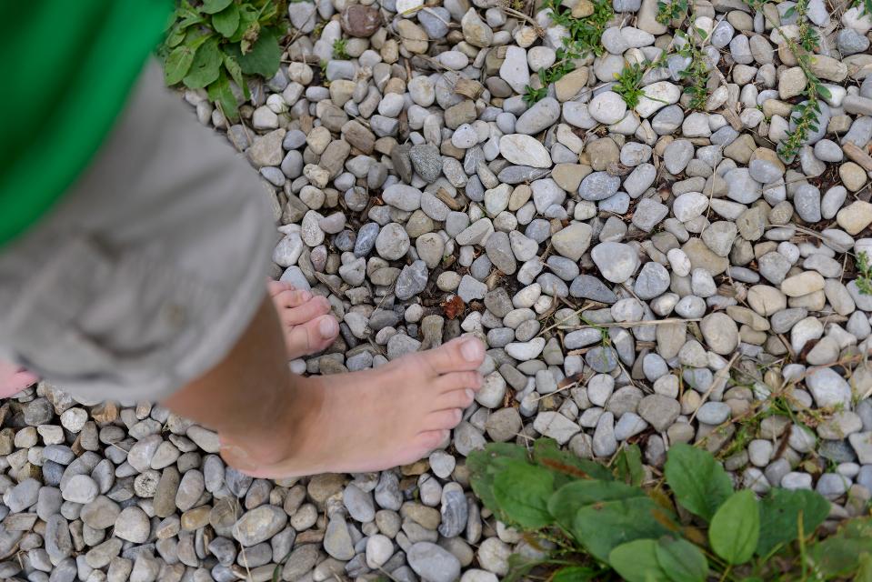
Besonders geeignet für:


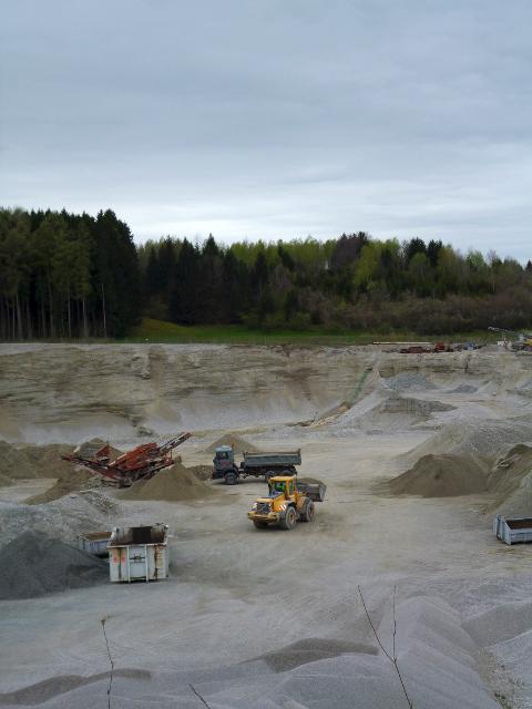

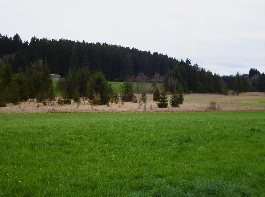
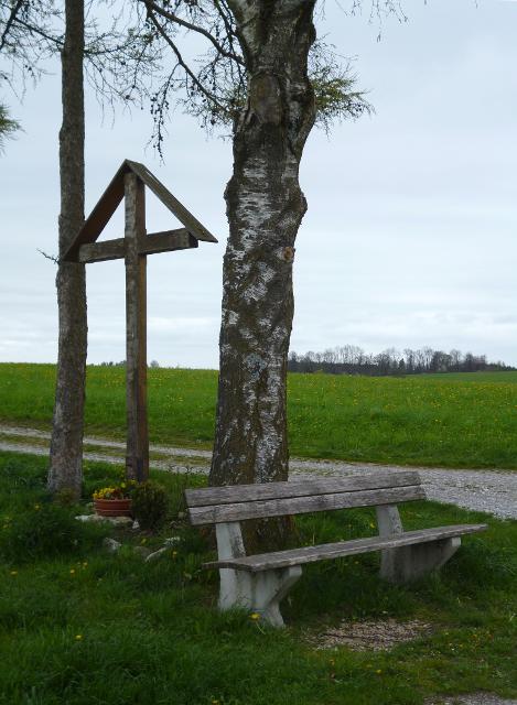
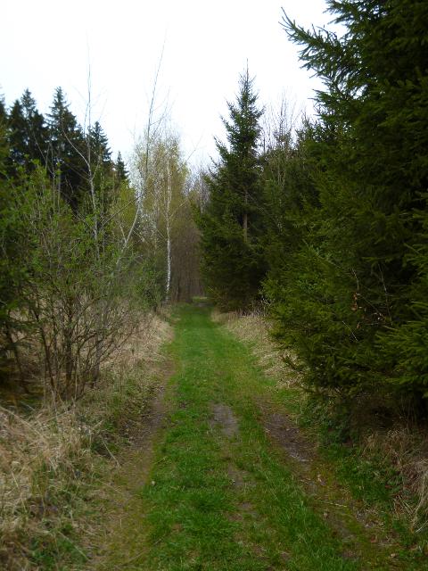

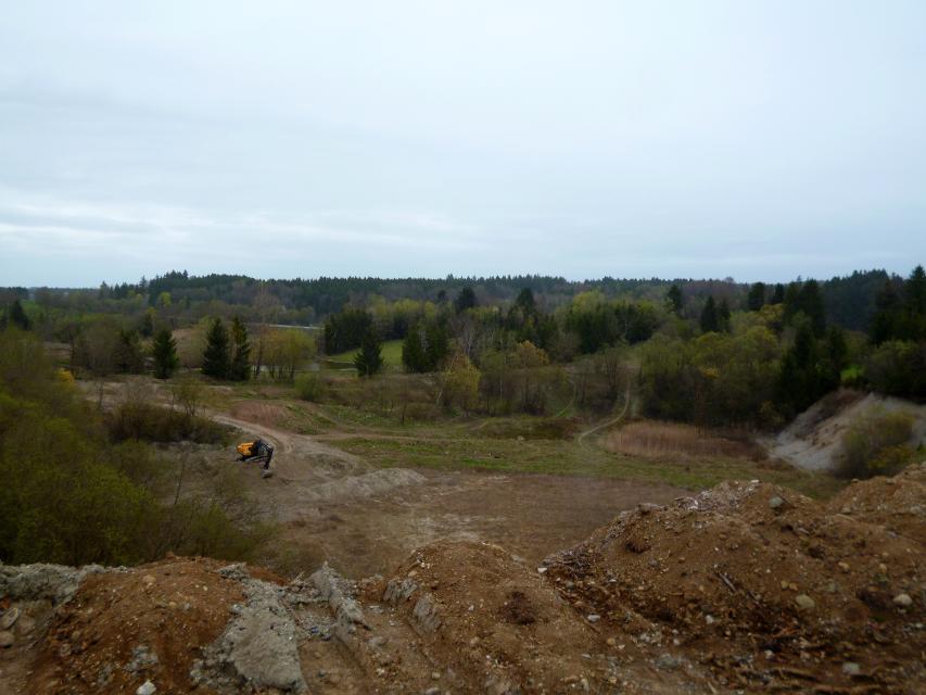
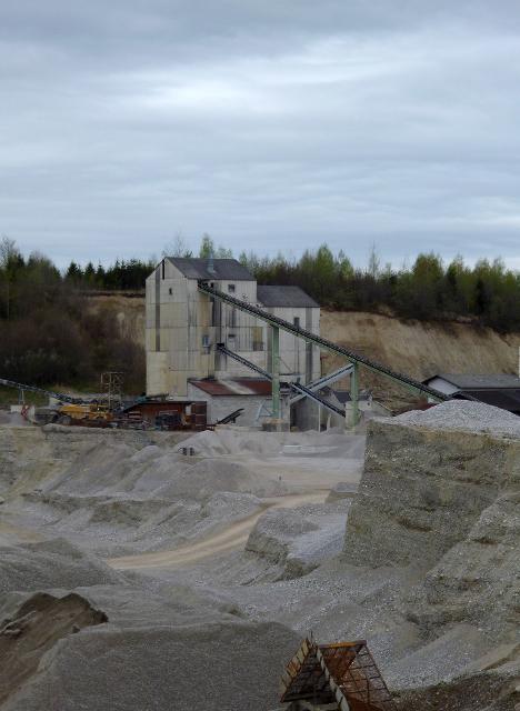

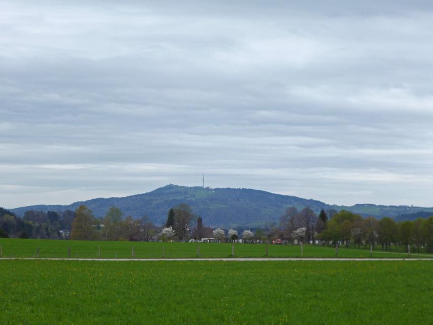

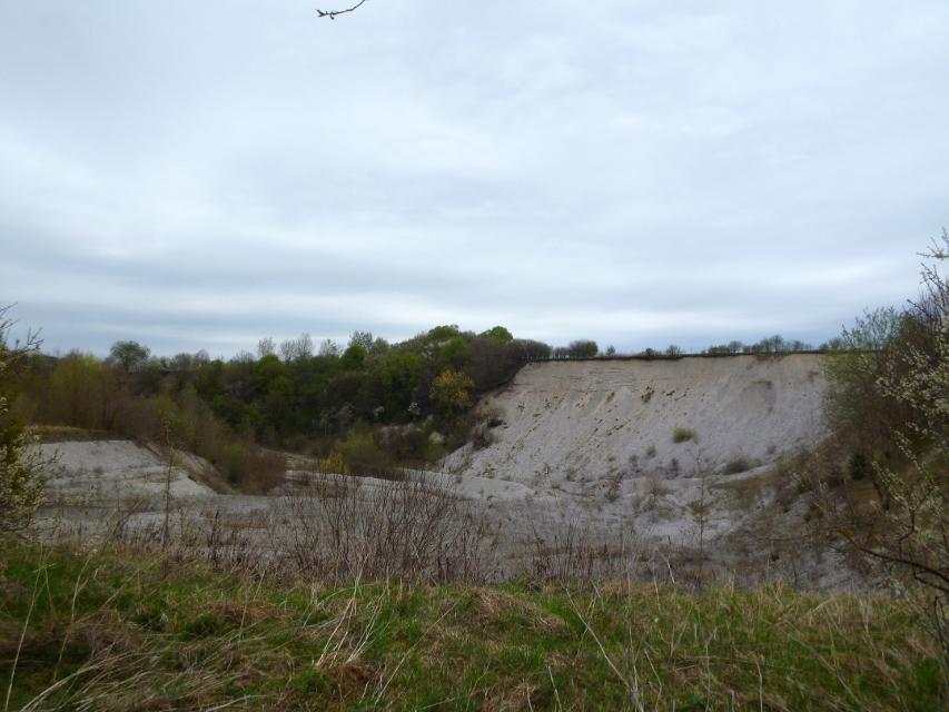
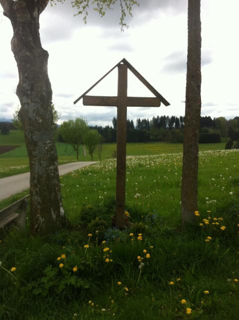
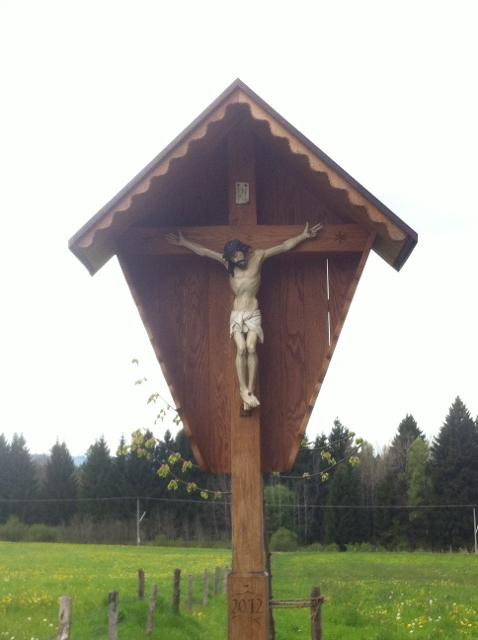
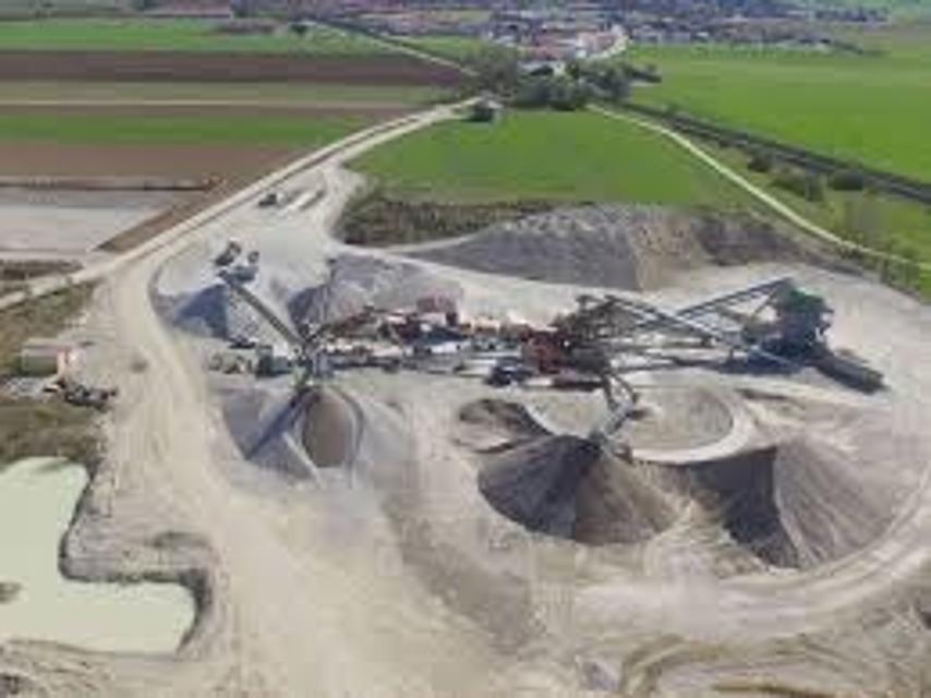
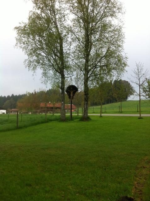
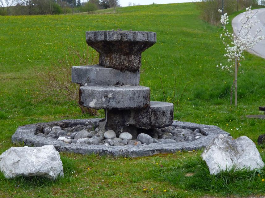
Der Stein-Erlebnisweg steht ganz im Zeichen des Tuffstein- und Kiesabbaus rund um Huglfing. Vorbei an stillgelegten sowie noch heute genutzten Kiesgruben führt die ausgedehnte Runde durch die sanfte Hügellandschaft südlich und östlich der oberbayerischen Gemeinde.
Beschildert: T62, rot
-
Aufstieg: 198 hm
-
Abstieg: 198 hm
-
Länge der Tour: 14,8 km
-
Höchster Punkt: 661 m
-
Differenz: 70 hm
-
Niedrigster Punkt: 591 m
Schwierigkeit
mittel
Kondition
mittel
Panoramablick
mittel
Saisonale Eignung
-
JAN
-
FEB
-
MRZ
-
APR
-
MAI
-
JUN
-
JUL
-
AUG
-
SEP
-
OKT
-
NOV
-
DEZ
Merkmale Touren
Aussichtsreich
Geologische Highlights
Rundweg
Einkehrmöglichkeit
Familientauglichkeit
Parkplatz am Bahnhof in Huglfing-Oberhausen. Alternativ: Eingeschränkte Parkmöglichkeiten in der Ortsmitte von Huglfing
aus Richtung Osten: Auf der A95 bis zur Ausfahrt Sindelsdorf, weiter über die B472 nach Huglfing.
Mit öffentlichen Verkehrsmitteln: Mit dem Zug nach Huglfing. Vom Bahnhof zu Fuß zum alternativen Startpunkt (ca. 1,8 km) in der Ortsmitte.
Startpunkt: Bahnhof in Huglfing
Ziel: Bahnhof in Huglfing
Navigation starten:


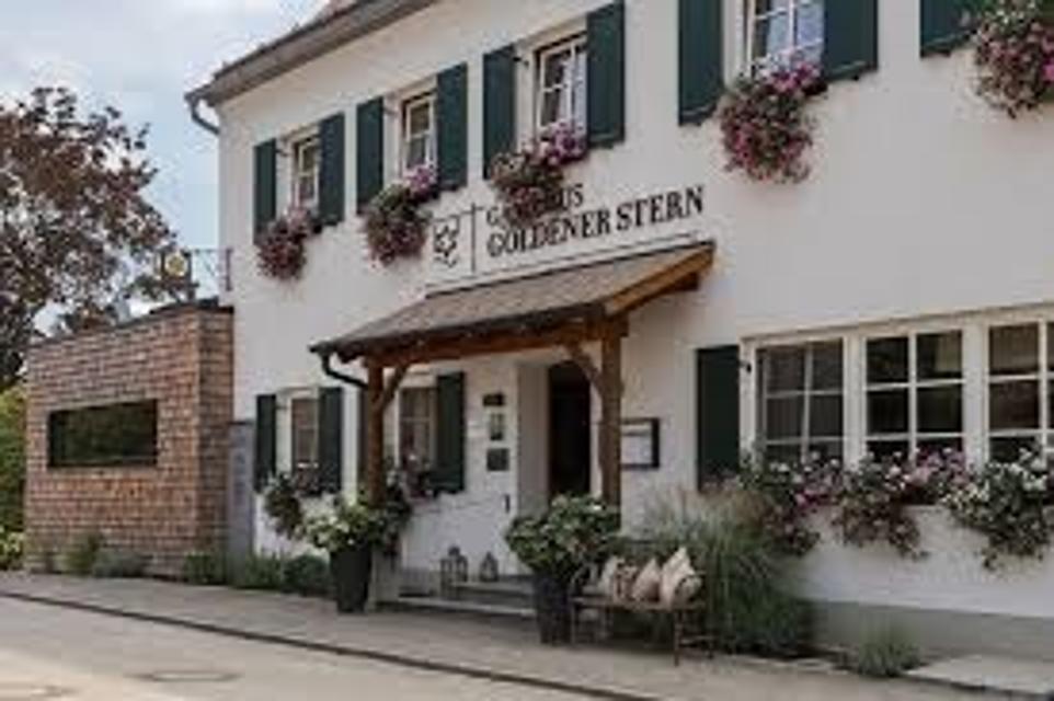
Hier befindet sich auch


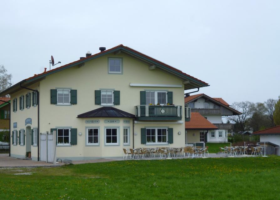
Bauern-Café
Huglfinger Straße 23, 82436 Eglfing-Tauting, Germany
Cafe mit hausgemachten Kuchen, Torten und Laden mit eigenem Hofkäse, Honig u.v.a. mit Blick übers Blaue Land in die Berge!
Essen in der Nähe
"Essen in der Nähe" überspringen
ca. 0,0 km entfernt
Gaststätte Alter Wirth
Hauptstr. 25, 82386 Huglfing, Germany
Das urige Gasthaus bietet nicht nur beste bayerische Hausmannskost und regionale Küche, sondern auf Wunsch auch ausgefallenere Köstlichkeiten . Dies haben wir Chefkoch Silvio zu verdanken, da er seinen Beruf unter einem französischen Küchenchef erlernen durfte.

ca. 1,8 km entfernt
Café Hey Schaffner
Weilheimer Str. 30, 82386 Huglfing, Germany
Das Café Hey Schaffner ist ein kleines Café im Bahnhof der Gemeinde Huglfing und bietet seinen Gästen neben selbstgebackenen Kuchen, hausgemachten Suppen, ...

ca. 2,5 km entfernt
Café Hausen, Oberhausen
Schulstraße 1, 82386 Oberhausen, Germany
Genießen Sie selbstgemachte Kuchen, köstliche Schmankerl und eine kleine Auszeit bei uns im Café in Oberhausen.

ca. 2,5 km entfernt
Gasthaus Strobl
Dorfstr. 6, 82386 Oberhausen, Germany
Ihr gemütliches Landgasthaus im Herzen des Pfaffenwinkels.

ca. 2,7 km entfernt
Bauerncafé Tauting
Huglfinger Straße 30, 82436 Eglfing, Germany
Inmitten herrlicher Naturlandschaft liegt dieses Café direkt am Radweg und bietet nebs köstlichem Kaffee und Kuchen ein reizvolles Panorama.
ca. 2,8 km entfernt
Bauern-Café
Huglfinger Straße 23, 82436 Eglfing-Tauting, Germany
Cafe mit hausgemachten Kuchen, Torten und Laden mit eigenem Hofkäse, Honig u.v.a. mit Blick übers Blaue Land in die Berge!


ca. 4,2 km entfernt
Gaststätte Waldherr
Ringstrasse 11, 82390 Eberfing, Germany
Gelegen in Mitten des herrlichen Pfaffenwinkels. Direkt in den bayrischen Voralpen.

ca. 5,4 km entfernt
Klosterwirtschaft
Weilheimer Str. 12, 82398 Polling, Germany
Die Alte Klosterwirtschaft ist ein ideales Ausflugsziel im oberbayerischen Pfaffenwinkel.

ca. 6,1 km entfernt
Camping-Stüberl
Badstrasse 51, 82380 Peißenberg, Germany
Restaurant mit Biergarten für alle Anlässe. Für alle Ausflugsgäste, Wanderer und Spaziergänger direkt am Pfaffenweg.

ca. 7,2 km entfernt
Trifthofstüberl
Trifthofstr. 57, 82362 Weilheim, Germany
In diesem gemütlichen und rustikalen Lokal wird Ihnen gutbürgerliche Küche serviert. In zwei getrennten Räumen ist Platz für bis zu 50 Personen. Am separaten Imbiss im separaten vorderen Bereich können Sie täglich (ausser Wochenende) ab 7.00-14:00 Uhr frisch zubereitete Speisen mitehmen.

ca. 7,5 km entfernt
Museumscafé Reinthal
Reinthal 2, 82395 Obersöchering, Germany
Idyllisch am großen Hof gelegen, inmitten der Natur, köstliche und riesengroße Kuchen genießen.


ca. 7,8 km entfernt

ca. 7,9 km entfernt
Gasthof Sonne
Hauptstraße 92, 82380 Peißenberg, Germany
Gemütliches Hotel und Gasthaus Sonne in Peißenberg südlich vom Ammersee. Moderne Zimmer, Restaurant, Natur

ca. 7,9 km entfernt
Gartencafé Wieshof
Wieshof 1, 82362 Weilheim-Marnbach, Germany
Idyllisch inmitten der Natur lädt eine Oase der Ruhe zum Verweilen ein. Kaffee und selbst gebackener Kuchen kann inmitten des Gartens genossen werden...

ca. 8,0 km entfernt
Hotel Restaurant Pöltner Hof Weilheim
Pollinger Str. 4 & 6, 82362 Weilheim in Oberbayern, Germany
Die zentrale Lage im Zentrum von Weilheim und die schmackhafte Küche lockt Gäste von Nah und Fern in unser Restaurant. Reservieren Sie Ihren Tisch online.
Unterkünfte in der Nähe
"Unterkünfte in der Nähe" überspringen


ca. 6,0 km entfernt


ca. 7,4 km entfernt
Ferienwohnung Elisabeth
Wettersteinstraße 8, 82362 Weilheim i. OB, Deutschland


ca. 8,0 km entfernt

ca. 8,0 km entfernt
Wohnmobilstellplatz Alte Bergehalte Peißenberg
Zur Alten Bergehalde 8, 82380 Peißenberg, Germany
Der neu eingerichtete Wohnmobilstellplatz "Alte Bergehalte" bietet nahezu Full-Service für wenig Geld.

Weitere Tipps in der Nähe
"Weitere Tipps in der Nähe" überspringen

ca. 0,1 km entfernt
Etappe 7, Ostschleife, Heilige Landschaft Pfaffenwinkel - Von Huglfing nach Peißenberg
Die siebte Etappe der Ostschleife des Fernwanderwegs Heilige Landschaft Pfaffenwinkel führt uns von Huglfing nach Peißenberg zur Böbinger Ammerbrücke. Auf abwechslungsreichen Wegen wandern wir durch die malerische Hügellandschaft des Pfaffenwinkels, ehe ab Buchen der anspruchsvolle Abstieg zur Ammerbrücke beginnt.
4:00 h 389 hm 385 hm 15,3 km mittel


ca. 0,3 km entfernt
Gut Grasleiten - Kindergeburtstag
Grasleiten, 82386 Huglfing, Germany
Kindergeburtstag auf Gut Grasleiten


Das könnte Dir auch gefallen
"Das könnte Dir auch gefallen" überspringen")
Hardtrunde (lang)
Die ausgedehnte Runde führt über weite Strecken durch die einzigartige Hardtlandschaft mit Hoch- und Niedermooren, Magerrasen- und Streuwiesengebieten sowie weitläufigen Wäldern. Auf dem landschaftlich äußerst reizvollen Weg über kaum befahrene Sträßchen und ruhige Forstwege genießen Spaziergänger immer wieder traumhafte Ausblicke auf die Alpenkette. Beschildert: Nr. 44, rot
2:30 h 109 hm 109 hm 9,6 km mittel

Hardtrunde (mittel)
Die landschaftlich reizvolle Hardtrunde führt in ihrem östlichen Teil durch die wunderschöne, äußerst vielfältige Hardtlandschaft. Saftig grüne Wiesen wechseln sich immer wieder mit weitläufigen Wald- und Moorgebieten ab. Im Gegensatz dazu ist der westliche Teil der Runde geprägt durch die weiten, häufig landwirtschaftlich genutzten Felder und Wiesen rund um den Dietlhofer See, der sich im Sommer hervorragend zum Baden eignet. Beschildert: Nr. 43, blau
2:00 h 88 hm 88 hm 7,1 km sehr leicht

Rundweg um den Fohnsee
Inmitten des Naturschutzgebiets Osterseen bietet der Rundweg um den Fohnsee ein einzigartiges Naturerlebnis. Spaziergänger genießen immer wieder traumhafte Blicke über die weitläufige Seenlandschaft. Zahlreiche idyllische Plätze am Ufer des Fohnsees und des Großen Ostersees locken zum Verweilen. Beschildert: Nr. 23, grün
1:15 h 41 hm 41 hm 4,9 km sehr leicht

Stadt- und Lechgeschichten
Wissenswerte Geschichten ranken sich um die historische Altstadt Schongaus. Zuerst erleben wir jedoch romantische Wanderwege, ehe wir die Altstadt mit dem gotischen Ballenhaus, der barocken Stadtpfarrkirche Mariae Himmelfahrt und der begehbaren Stadtmauer entdecken.
3:45 h 276 hm 276 hm 13,9 km mittel
Winterwanderung - Stadt- und Lechgeschichten
Wissenswerte Geschichten ranken sich um die historische Altstadt Schongaus. Zuerst erleben wir jedoch romantische Wanderwege, ehe wir die Altstadt mit dem gotischen Ballenhaus, der barocken Stadtpfarrkirche Mariae Himmelfahrt und der begehbaren Stadtmauer entdecken.
3:45 h 114 hm 114 hm 13,9 km mittel

Höllfilzweg
Die Gemeinde Antdorf in Oberbayern besticht mit ihrer traumhaften Lage nahe der Osterseen und unweit von Penzberg. Wenig frequentierte Wanderwege und Wiesenpfade sorgen auf dem gemütlichen Spazierweg für Erholung in der pfaffenwinkler Landschaft. Grüne Sommerwiesen vor einem prächtigen Alpenpanorama, historische Kirchen und eine kleine Kapelle versprechen Wandervergnügen im Voralpenland. Beschildert: Nr. 7, blau
2:15 h 85 hm 85 hm 8,4 km mittel


Kultur - Ammerschlucht
Die Tour führt über Stufen, Stege und Brücken durch die ungebändigte Ammerschlucht und durch wildromantische Mischwälder. Der Weg entlang der Schlucht und der Pfad an der Reitnerbachklamm fordern die Trittsicherheit der Wanderer. Die zum Teil herausfordernden Wege werden mit außergewöhnlichen Ausblicken belohnt. Beschildert: Nr. 88, rot
6:00 h 211 hm 211 hm 21,1 km mittel

Naturwunder-Tour
Über grüne Wiesen, flache Hügel und ruhige Wälder zum Naturschutzgebiet Litzauer Schleife. Hier ist Lech nahezu unberührt und bietet vielen Pflanzen und Tieren einen einzigartigen Lebensraum. Atemberaubende Aussichten inklusive. Beschildert: B2, grün
2:05 h 59 hm 59 hm 8,1 km sehr leicht

Ostschleife "Spiegelnde Wasser" - Heilige Landschaft Pfaffenwinkel
Drei Mehrtageswanderungen führen durch die schönsten Ecken des oberbayerischen Pfaffenwinkels, dessen Kultur über Jahrhunderte durch zahlreiche Klöster geprägt wurde. Die ruhigen Wanderwege verbinden Kirchen, Klöster und Kraftorte in der Natur. Die drei Pilgerwege starten und enden am Hohen Peißenberg, der einen Rundblick über die gesamte Region bietet und als bedeutender Wallfahrtsort dafür prädestiniert ist. Auf der Ostschleife mit dem Thema „spiegelnde Wasser“ führen 8 Tagesetappen mit einer Gesamtlänge von 139 km zu den bedeutenden Klosterorten Polling, Bernried und Benediktbeuern. Landschaftlich geprägt ist die Route vom Starnberger See und den Osterseen sowie den unzähligen Seen und Weihern am Weg, in denen man sich und sein Leben spiegeln kann.
40:00 h 1750 hm 1750 hm 139,3 km sehr schwer
")
Hardtrunde (kurz)
Die kurze Version der Hardtrunde streift die typische Hardtlandschaft östlich von Weilheim nur am Rande. Im Zentrum steht vielmehr das sanfte Hügelland rund um den idyllischen Dietlhofer See, einem beliebten Badesee im Norden von Weilheim. Immer wieder genießen Spaziergänger wunderschöne Ausblicke auf den See und den Weiler Dietlhofen. Beschildert: Nr. 42, grün
1:00 h 47 hm 47 hm 3,9 km sehr leicht

Illach-Rundweg
Der flache Rundweg nahe der Illach führt Wanderer durch die weitläufige Landschaft des Pfaffenwinkels. Während Kulturinteressierte in Steingaden die Spuren der Welfendynastie erforschen können, ist für Naturliebhaber der türkisfarbene Lechstausee eine wunderbare Sehenswürdigkeit. Ausgeschildert mit der Nr. 120, rot.
2:30 h 154 hm 154 hm 9,4 km mittel

Schäfflerweg
Der Schäfflerweg ist eine wunderschöne Wanderrunde mit Start in Peißenberg, der Marktgemeinde des lebendig gebliebenen Bergbaus.
3:15 h 235 hm 235 hm 10,7 km mittel

Seewiesenweg
Die gemütliche Spazierrunde ist zwar kurz, aber dafür umso abwechslungsreicher. Begleitet von einem traumhaften Alpenpanorama führt der Weg nach Huglfing, bevor es durch die einzigartige Grasleitner Moorlandschaft zurück nach Oberhausen geht. Beschildert: Nr. 63, grün
1:00 h 47 hm 47 hm 4,0 km sehr leicht

Kleine Moorrunde und Barfußpfad Bad Bayersoien
Der Moor- und Seelehrpfad Bad Bayersoien umfasst die „Kleine Moorrunde“ am Ostufer des Soier Sees mit etwa 1 km Wegstrecke und vielen Infos rund ums Moor und den reizvollen „Barfußpfad“ rund um den See mit etwa 1,8 km.
0:52 h 9 hm 9 hm 3,5 km sehr leicht

Bergwetter-Weg
In exponierter Lage führt die Spazierrunde auf gut beschilderten Wegen zu den spannenden Sehenswürdigkeiten des Hohen Peißenbergs. Auf der Runde erwartet uns die älteste Bergwetterstation der Erde, eine Entdeckungsreise durch die Welt des Klimas und die Wallfahrtskirche Maria Himmelfahrt. Beschildert: Nr. 82, blau
1:30 h 196 hm 196 hm 4,8 km sehr leicht

Kirchen-Rundweg Iffeldorf
Das Ziel des kurzen Rundwegs ist die Wallfahrtskirche St. Maria im Heuwinkl. Die als Heuwinklkapelle bekannte Kirche liegt wunderschön auf einer Anhöhe östlich von Iffeldorf. Sie gilt als eine der schönsten Kapellen im gesamten bayerischen Oberland. Durch ihre exponierte Lage und ihren originellen runden Bau mit der großen roten Kuppel ist sie schon von Weitem sichtbar. Beschildert: Nr. 24, grün
0:45 h 39 hm 39 hm 2,8 km sehr leicht

Panoramarunde Steingaden
Die Panoramarunde führt uns von Steingaden zum Lechstausee. Sobald wir Steingaden verlassen haben und den Storchenmoosweiher passiert haben, öffnet sich uns ein gigantisches Alpenpanorama, das uns bis zum Ausgangspunkt zurück begleiten wird. Beschildert: Nr. 115, blau
2:15 h 95 hm 92 hm 7,6 km mittel

Peitnachrunde
Die Tour führt von Peiting zum Kalvarienberg und an der Peitnach entlang. Eine malerische Runde mit Alpenblick und Sicht auf den Hohen Peißenberg. Vor allem für Familien mit Kindern ist der Walderlebnispfad auf dem Kalvarienberg ein spannendes Erlebnis. Beschildert: Nr. 100, grün
2:00 h 147 hm 149 hm 6,4 km mittel

Pfaffenwinkler Milchweg
Auf dem Pfaffenwinkler Milchweg bei Schönegg können Wanderer alles rund um das Thema Milch Schritt für Schritt erleben. Auf dem Themenweg gibt es zehn Stationen, die Wissenswertes und Spannendes rund um das Thema Milch und Landwirtschaft kindgerecht präsentieren.
1:30 h 88 hm 89 hm 4,2 km sehr leicht


Stadt- und Waldrunde
Die ausgedehnte Stadt- und Waldrunde in und um Penzberg wartet mit abgelegenen Aussichtspunkten, traumhaften Gewässen und weitläufigen Filzgebieten in Stadtnähe auf. Im Erholungsgebiet Berghalde wandert man auf den Spuren des Bergbaus und erfährt Wissenswertes zur Geschichte der Stadt Penzberg. Für junge Wanderer ist das Freizeitgebiet Gut Hub eine spannende Abwechslung. Beschildert: Nr. 1, rot
4:45 h 225 hm 225 hm 18,2 km mittel

Wald- und Weiherschleife
Die ausgedehnte Wald- und Weiherschleife, verläuft auf abwechslungsreichen Wegen mit vielen Sehenswürdigkeiten um Penzberg, die Stadt der 74 Nationen. Die Wanderung führt an landschaftlich reizvollen Plätzen vorbei, an romantischen Seen entlang und zu historischen Baudenkmälern. Auf dieser Runde präsentiert sich der Pfaffenwinkel von seiner schönsten Seite. Beschildert: Nr. 2, rot
4:30 h 242 hm 242 hm 16,4 km mittel

Wanderweg zum Hohen Peißenberg
Der Wanderweg zum Hohen Peißenberg ist eine anspruchsvolle Tour mit vielen Höhenmetern. Wenn der Berggipfel erreicht ist, wartet eine Vielzahl an Sehenswürdigkeiten und ein herrlicher Rundumblick auf erkundungsfreudige Wanderer. Die Wallfahrtskirche, das Observatorium und der Fernsehturm sind nur einige der Attraktionen. Für junge Wanderer ist der Wetterlehrpfad eine spannende Reise in die Welt des Klimas. Beschildert: Nr. 77, blau
3:15 h 381 hm 381 hm 10,7 km mittel


Klosterweiher-Weg
Der Klosterweiherweg ist eine ausgedehnte und idyllische Runde in der typischen Moränenlandschaft um Bernried. Die fünf Weiher, die dieser Weg verbindet. entstanden in einer wirtschaftlichen Verbindung zu dem früheren Kloster der Augustinerchorherren und sind heute schöne Orte der Meditation.
4:30 h 139 hm 144 hm 13,3 km mittel

St. Nikolaus-Weg
Der St. Nikolaus-Weg ist eine romantische Wanderung durch die ausgedehnten Wälder um Kreilhof, St. Nikolaus und Achberg. Die Wege an der Ach und der Eyach entlang sorgen mit wenigen Höhenmetern für Erholung und Natur pur. An mehreren Aussichtspunkten kann man einen herrlichen Weitblick auf die Alpenkette und den Hohen Peißenberg genießen. Beschildert: Nr. 67, grün
2:30 h 129 hm 129 hm 10,8 km mittel
