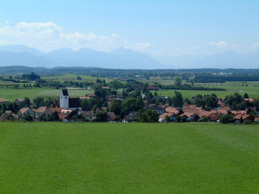
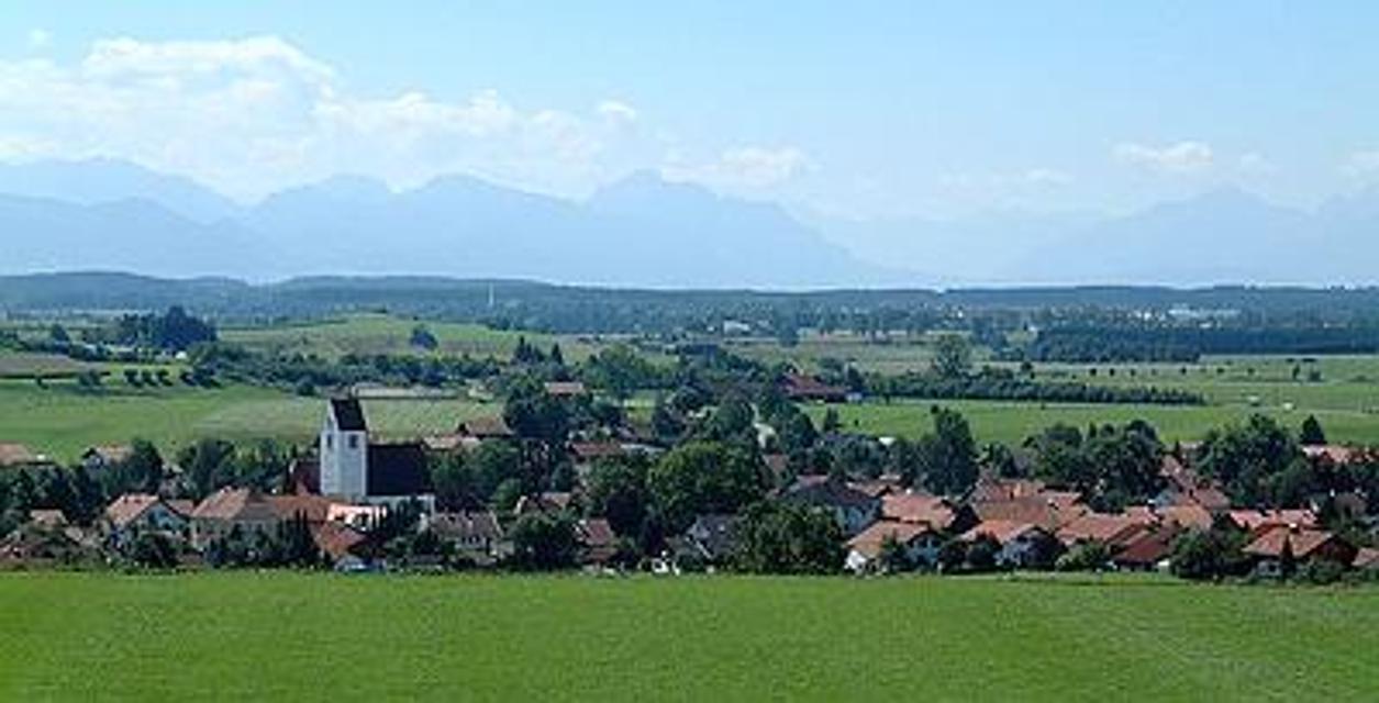
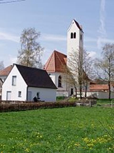
Die Lechblickrunde verbindet Hohenfurch über einen Rundweg mit dem Lech-Höhenweg und Fernwanderweg Romantische Straße (siehe eigene Beschreibungen). Aus dem Talkessel von Hohenfurch herausführend ergeben sich gleich zu Beginn schöne Blickbeziehungen in dem sanft hügeligen Flurbereich nordöstlich Hohenfurch.
-
Aufstieg: 51 hm
-
Abstieg: 51 hm
-
Länge der Tour: 6,4 km
-
Höchster Punkt: 734 m
-
Differenz: 50 hm
-
Niedrigster Punkt: 684 m
Schwierigkeit
mittel
Kondition
mittel
Panoramablick
mittel
Saisonale Eignung
-
JAN
-
FEB
-
MRZ
-
APR
-
MAI
-
JUN
-
JUL
-
AUG
-
SEP
-
OKT
-
NOV
-
DEZ
Merkmale Touren
Rundweg
Einkehrmöglichkeit
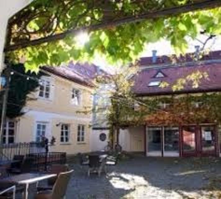
Hohenfurch Ortsmitte


Hier befindet sich auch
Essen in der Nähe
"Essen in der Nähe" überspringen
ca. 3,5 km entfernt
Schreinercafé
Friedhofweg 9, 86972 Altenstadt, Germany
Wer im Schreinercafé sitzt, genießt von der Frau des Schreinermeisters Richard Kögl täglich frisch gebackenen Kuchen , frisch gebrühten Kaffee wie er schon einst von Oma zubereitet wurde, und einen unverstellten Blick auf die romanische Basilika unweit des Cafés

ca. 4,1 km entfernt

ca. 4,1 km entfernt
Lagerhaus
Karmeliterstr. 5, 86956 Schongau, Germany
Restaurant, mit Cafe und Bar. Seit dem Umbau kann das Lagerhasu auch mit einem Kinobesuch der besonderen Art aufwarten.

ca. 4,4 km entfernt
Herzog Cafe und Wirtshaus in Herzogsägmühle
Dorfplatz 8, 86971 Peiting-Herzogsägmühle, Germany
Das Café Herzog ist das öffentliche Café und Wirtshaus in Herzogsägmühle, mit Spielplatz, Minigolf und zwei Kegelbahnen. Unsere Speisekarte ist klein, aber fein. Wo immer möglich, verarbeiten wir regionale und nachhaltig erzeugte Produkte – selbstverständlich auch aus Herzogsägmühler Betrieben wie der Metzgerei, der Bäckerei sowie der Gärtnerei.Ebenso stellen wir viele Produkte hausgemacht her – wir haben Freude daran und hoffen, Sie mit unseren Speisen ein wenig verwöhnen zu können.Wir bieten Frühstück, Mittagessen und am Nachmittag können Sie sich auf erfrischende Eisbecher sowie hausgemachten Kuchen freuen. Unser barrierefreies Restaurant wurde mehrfach für seinen kinder- und familienfreundlichen Service ausgezeichnet.


ca. 5,9 km entfernt
Restaurant Zauberhütte
Mößle 2, 86971 Peiting, Germany
Idyllisch und ruhig gelegen inmitten von Wiesen mit traumhaften Ausblick auf das Alpenpanorama.


ca. 6,3 km entfernt
Hotel-Restaurant „Zum Dragoner“ OHG
Ammergauer Str. 11 + 16, 86971 Peiting, Deutschland

ca. 6,8 km entfernt
Bäckerei & Café Sesar
Bahnhofstraße 21, 86971 Peiting, Germany
Handwerklich-traditionelle Backkunst aus Peiting.

Unterkünfte in der Nähe
"Unterkünfte in der Nähe" überspringen


ca. 4,2 km entfernt


ca. 4,4 km entfernt
Wohnmobilstellplatz Schongau
Lechuferstraße, 86956 Schongau, Germany
Der Wohnmobilstellplatz befiindet sich in unmitelbarer Nähe des beliebten Erlebnisbades Plantsch an der Lechuferstraße. Dieser bietet 70 sonnige sowie teilweise schattige Plätze. Von dort aus ist über einenFußweg die Historische Altstadt in wenigen Minuten zu erreichen. Dort bietet sich eine attraktive Auswahl an Gastronomie, Geschäften, Fußgängerzone sowie auch historisch bedeutsame Punkte zur Besichtigung. Ein gleichfalls attraktives Ausflugsziel vom Wohnmobilstellplatz aus ist der Badestrand mit seinem gastronomisch bewirtschafteten Bootshaus am Schongauer Stausee "Lido"


Weitere Tipps in der Nähe
"Weitere Tipps in der Nähe" überspringen


ca. 1,6 km entfernt

ca. 1,9 km entfernt
Kappelle St. Ignatius Schwabniederhofen
Kapellenstraße 18, 86972 Altenstadt, Germany
Das genaue Baujahr ist unbekannt. Im Urkataster aus dem Jahr 1825 wird sie allerdings bereits erwähnt. Befunduntersuchungen von Paul Ressl haben ergeben, dass die restaurierte Fassung wohl aus dem dritten Viertel des 19. Jahrhunderts stammen dürfte.


ca. 2,6 km entfernt
Klinikum Schongau
Marie-Eberth-Straße 6, 86956 Schongau, Germany
Das Krankenhaus Schongau ist mit 180 Betten das größere der beiden Häuser der Krankenhaus GmbH


Das könnte Dir auch gefallen
"Das könnte Dir auch gefallen" überspringen
Lechsee-Rundweg
Landschaftlich reizvoller Rundweg um den Lechstausse. Abwechslungsreiche ca. 8 km lange Strecke mit herrlichen Aussichten. Einfacher Wanderweg, Gehdauer ca. 2 Stunden. Einkehrmöglichkeiten liegen an der Strecke. Ein Kneippbecken und diverse Erlebnisstationen können zwischen Lechbruck und dem Via Claudia-Campingplatz erkundet werden.
2:30 h 25 hm 22 hm 8,4 km mittel

Rund um Rottenbuch
„Rund um Rottenbuch“ ist eine lange aber sehr abwechslungsreiche Tour, die auch jederzeit abgekürzt werden kann. Landschaftlich hat der Weg viel zu bieten: Er führt durch Wälder, kleine Schluchten und die Aussichtspunkte Mühlegg und Schmauzenberg bieten ein tolles Bergpanorama. Am Ende der Runde ist der Besuch der ehemaligen Klosterstiftskirche zu empfehlen. Beschildert: Nr. 95, rot
3:22 h 232 hm 232 hm 12,5 km mittel


Durch Berg und Tal
Die ausgedehnte Runde um Oberhausen und Huglfing macht ihrem Namen alle Ehre. In stetem Auf und Ab geht es durch die wunderschöne, weitläufige Wiesen-, Moor- und Hügellandschaft im südlichen Pfaffenwinkel. Immer wieder genießen Spaziergänger ein traumhaftes Alpenpanorama. Beschildert Nr. 61, rot
3:15 h 197 hm 197 hm 12,2 km mittel

Großer Lauterbacher Waldweg
Teils auf ruhigen Forstwegen, teils auf kaum befahrenen Asphaltsträßchen durchstreifen Spaziergänger die sanfte Hügellandschaft nordwestlich des Großen Ostersees. Auch wenn die ausgedehnte Wanderung über weite Strecken durch dichte Wälder führt, bieten sich immer wieder wunderschöne Blicke auf die Alpenkette. Beschildert: Nr 21, rot
4:30 h 264 hm 264 hm 17,4 km mittel


Alpenblick-Wanderung
Raisting liegt in Oberbayern in unmittelbarer Nähe zum Ammersee. Die Erdfunkstelle ist das Wahrzeichen der Gemeinde, die schon von weitem zu sehen ist. Die Alpenblick-Wanderung welche mit der Nr. 52 auf grünem Grund beschildert ist, belohnt die Spaziergänger nicht nur mit einem herrlichen Weitblick auf das Alpenmassiv, sondern auch mit einem Blick auf die Erdfunkstelle. Beschilderung: Nr. 52, grün
1:15 h 53 hm 53 hm 4,7 km sehr leicht

Gögerlrunde
Die Wanderrunde mit Start am Gögerl ist eine Strecke mit schönen Aussichtspunkten und fantastischem Bergpanorama. Eine genussvolle Tour durch die herrliche Landschaft südöstlich von Weilheim, die allerlei Abwechslung, idyllische Natur und malerische Wälder bietet. Historisch geprägt ist der Wanderweg vom Umfeld der ehemaligen Gögerlburg, sowie von den Resten des Hechenbergwalls und der Sage vom Gögerlfräulein. Beschildert: T41, grün
1:30 h 137 hm 137 hm 5,3 km sehr leicht
")
Hardtrunde (kurz)
Die kurze Version der Hardtrunde streift die typische Hardtlandschaft östlich von Weilheim nur am Rande. Im Zentrum steht vielmehr das sanfte Hügelland rund um den idyllischen Dietlhofer See, einem beliebten Badesee im Norden von Weilheim. Immer wieder genießen Spaziergänger wunderschöne Ausblicke auf den See und den Weiler Dietlhofen. Beschildert: Nr. 42, grün
1:00 h 47 hm 47 hm 3,9 km sehr leicht

Höllfilzweg
Die Gemeinde Antdorf in Oberbayern besticht mit ihrer traumhaften Lage nahe der Osterseen und unweit von Penzberg. Wenig frequentierte Wanderwege und Wiesenpfade sorgen auf dem gemütlichen Spazierweg für Erholung in der pfaffenwinkler Landschaft. Grüne Sommerwiesen vor einem prächtigen Alpenpanorama, historische Kirchen und eine kleine Kapelle versprechen Wandervergnügen im Voralpenland. Beschildert: Nr. 7, blau
2:15 h 85 hm 85 hm 8,4 km mittel

Illach-Rundweg
Der flache Rundweg nahe der Illach führt Wanderer durch die weitläufige Landschaft des Pfaffenwinkels. Während Kulturinteressierte in Steingaden die Spuren der Welfendynastie erforschen können, ist für Naturliebhaber der türkisfarbene Lechstausee eine wunderbare Sehenswürdigkeit. Ausgeschildert mit der Nr. 120, rot.
2:30 h 154 hm 154 hm 9,4 km mittel


Knappensteig
Der Knappensteig verbindet den ausgeschilderten Stollenweg mit einer Besteigung des Hohen Peißenbergs, dem Panoramaberg im Pfaffenwinkel schlechthin. Entlang des mit zahlreichen Informationstafeln ausgestatteten Lehrpfads erfahren Wanderer interessante Details zum Bergbau rund um Peißenberg. Bei klarer Sicht reicht der Blick vom Hohen Peißenberg von den Chiemgauer Alpen über das Ester- und Wettersteingebirge bis zu den Ammergauer und Allgäuer Alpen. Beschildert: Nr. Nr. 83, rot
5:15 h 681 hm 681 hm 17,6 km sehr schwer

Kultur - Ammerschlucht
Die Tour führt über Stufen, Stege und Brücken durch die ungebändigte Ammerschlucht und durch wildromantische Mischwälder. Der Weg entlang der Schlucht und der Pfad an der Reitnerbachklamm fordern die Trittsicherheit der Wanderer. Die zum Teil herausfordernden Wege werden mit außergewöhnlichen Ausblicken belohnt. Beschildert: Nr. 88, rot
6:00 h 211 hm 211 hm 21,1 km mittel

Naturwunder-Tour
Über grüne Wiesen, flache Hügel und ruhige Wälder zum Naturschutzgebiet Litzauer Schleife. Hier ist Lech nahezu unberührt und bietet vielen Pflanzen und Tieren einen einzigartigen Lebensraum. Atemberaubende Aussichten inklusive. Beschildert: B2, grün
2:05 h 59 hm 59 hm 8,1 km sehr leicht

Osterbichl-Rundweg
Der Osterbichl-Rundweg führt uns durch das wunderschöne Voralpenland, wo Wanderer die sanfte Hügellandschaft östlich von Steingaden durchstreifen. Auf dieser Tour taucht man in den malerischen Brunnhäuslwald ein. Wann immer dieser verlassen wird, bieten sich wunderschöne Blicke auf die Alpen. Beschildert: Nr. 118, grün
1:15 h 118 hm 118 hm 4,6 km mittel


Schäfflerweg
Der Schäfflerweg ist eine wunderschöne Wanderrunde mit Start in Peißenberg, der Marktgemeinde des lebendig gebliebenen Bergbaus.
3:15 h 235 hm 235 hm 10,7 km mittel

Seewiesenweg
Die gemütliche Spazierrunde ist zwar kurz, aber dafür umso abwechslungsreicher. Begleitet von einem traumhaften Alpenpanorama führt der Weg nach Huglfing, bevor es durch die einzigartige Grasleitner Moorlandschaft zurück nach Oberhausen geht. Beschildert: Nr. 63, grün
1:00 h 47 hm 47 hm 4,0 km sehr leicht

Vogellehrpfad Bad Bayersoien
Auf 6 informativen Schautafeln entlang diesen Themenweges erfahren Sie alles über die reiche Vogelwelt am Soier See. Mit einem speziellen "TING"-Stift lassen Sie die Vogelwelt auch erklingen. Diesen "TING"-Stift können Sie sich in der Tourist-Information in Bad Bayersoien und im Fischerhäusl am Soier See gegen Pfand kostenlos aussleihen.
0:31 h 15 hm 15 hm 2,1 km sehr leicht

Bergwetter-Weg
In exponierter Lage führt die Spazierrunde auf gut beschilderten Wegen zu den spannenden Sehenswürdigkeiten des Hohen Peißenbergs. Auf der Runde erwartet uns die älteste Bergwetterstation der Erde, eine Entdeckungsreise durch die Welt des Klimas und die Wallfahrtskirche Maria Himmelfahrt. Beschildert: Nr. 82, blau
1:30 h 196 hm 196 hm 4,8 km sehr leicht
")
Hardtrunde (lang)
Die ausgedehnte Runde führt über weite Strecken durch die einzigartige Hardtlandschaft mit Hoch- und Niedermooren, Magerrasen- und Streuwiesengebieten sowie weitläufigen Wäldern. Auf dem landschaftlich äußerst reizvollen Weg über kaum befahrene Sträßchen und ruhige Forstwege genießen Spaziergänger immer wieder traumhafte Ausblicke auf die Alpenkette. Beschildert: Nr. 44, rot
2:30 h 109 hm 109 hm 9,6 km mittel

Hardtrunde (mittel)
Die landschaftlich reizvolle Hardtrunde führt in ihrem östlichen Teil durch die wunderschöne, äußerst vielfältige Hardtlandschaft. Saftig grüne Wiesen wechseln sich immer wieder mit weitläufigen Wald- und Moorgebieten ab. Im Gegensatz dazu ist der westliche Teil der Runde geprägt durch die weiten, häufig landwirtschaftlich genutzten Felder und Wiesen rund um den Dietlhofer See, der sich im Sommer hervorragend zum Baden eignet. Beschildert: Nr. 43, blau
2:00 h 88 hm 88 hm 7,1 km sehr leicht

Kirchen-Rundweg Iffeldorf
Das Ziel des kurzen Rundwegs ist die Wallfahrtskirche St. Maria im Heuwinkl. Die als Heuwinklkapelle bekannte Kirche liegt wunderschön auf einer Anhöhe östlich von Iffeldorf. Sie gilt als eine der schönsten Kapellen im gesamten bayerischen Oberland. Durch ihre exponierte Lage und ihren originellen runden Bau mit der großen roten Kuppel ist sie schon von Weitem sichtbar. Beschildert: Nr. 24, grün
0:45 h 39 hm 39 hm 2,8 km sehr leicht

Kleine Moorrunde und Barfußpfad Bad Bayersoien
Der Moor- und Seelehrpfad Bad Bayersoien umfasst die „Kleine Moorrunde“ am Ostufer des Soier Sees mit etwa 1 km Wegstrecke und vielen Infos rund ums Moor und den reizvollen „Barfußpfad“ rund um den See mit etwa 1,8 km.
0:52 h 9 hm 9 hm 3,5 km sehr leicht