Besonders geeignet für:


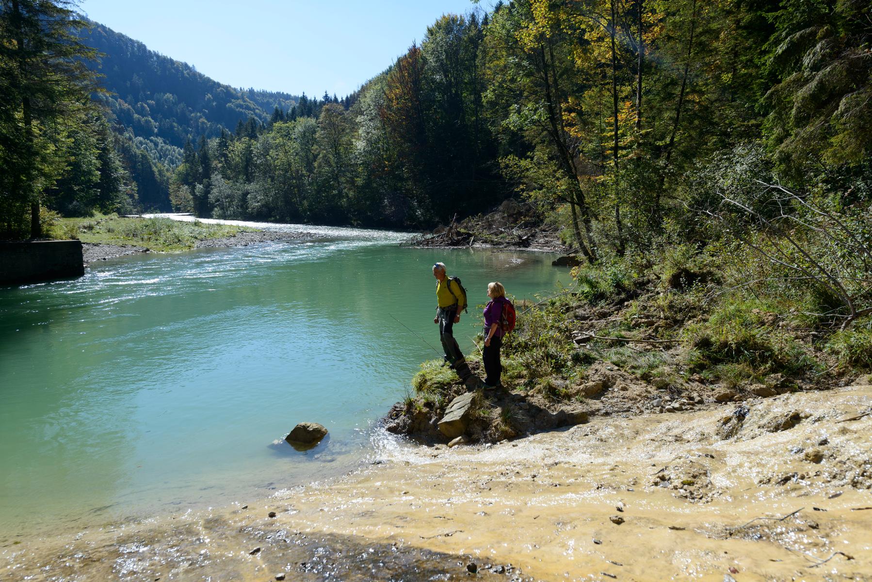
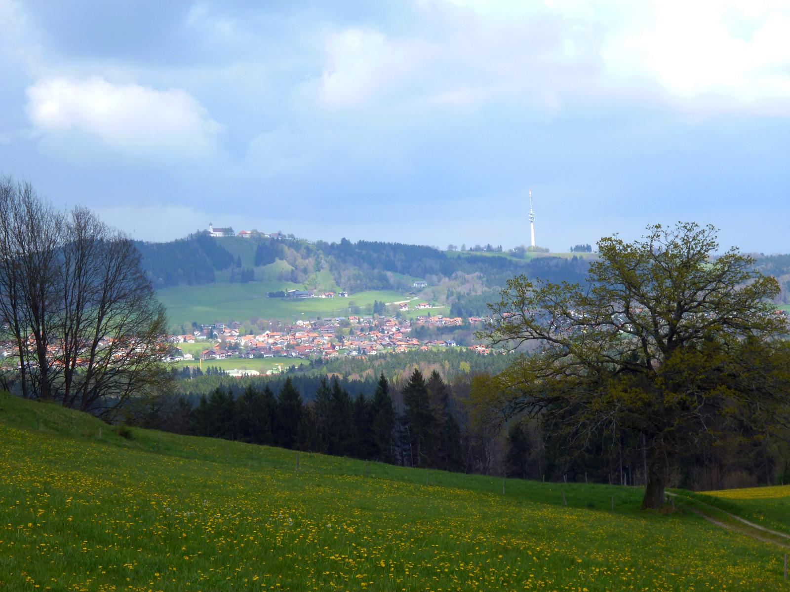
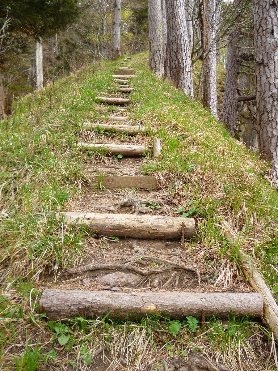
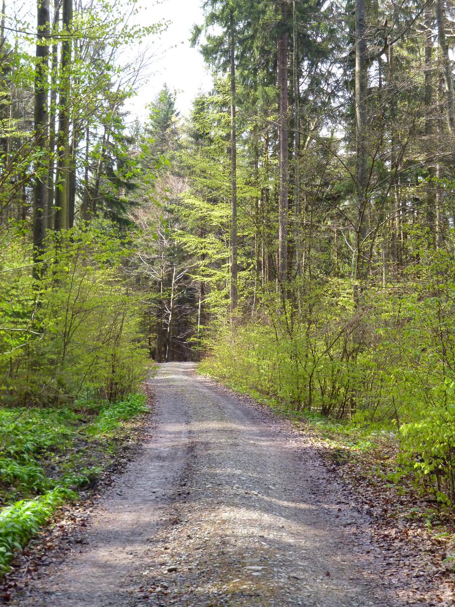
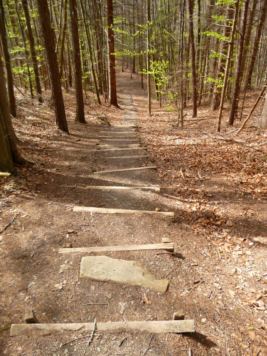
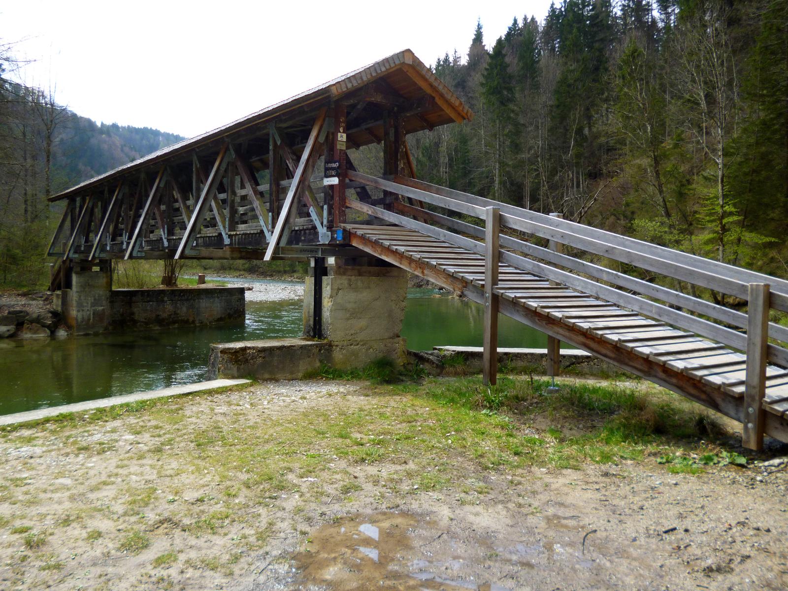
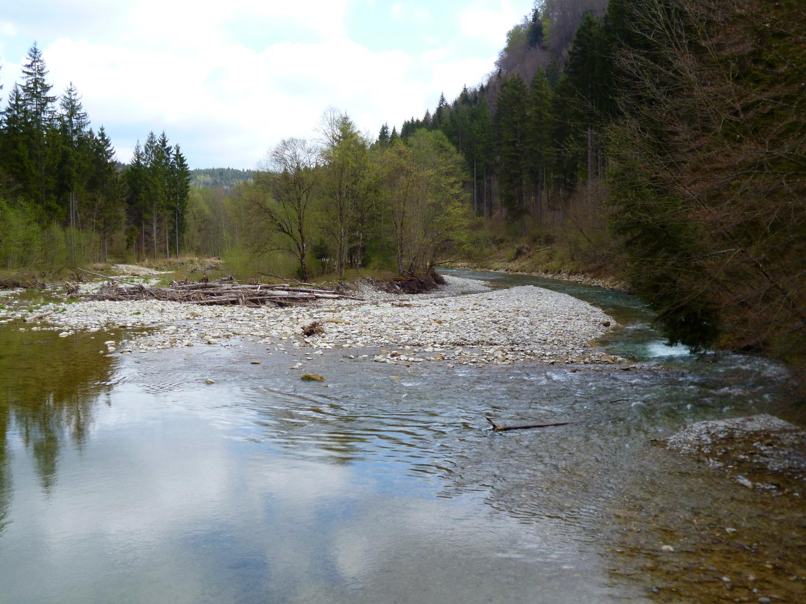
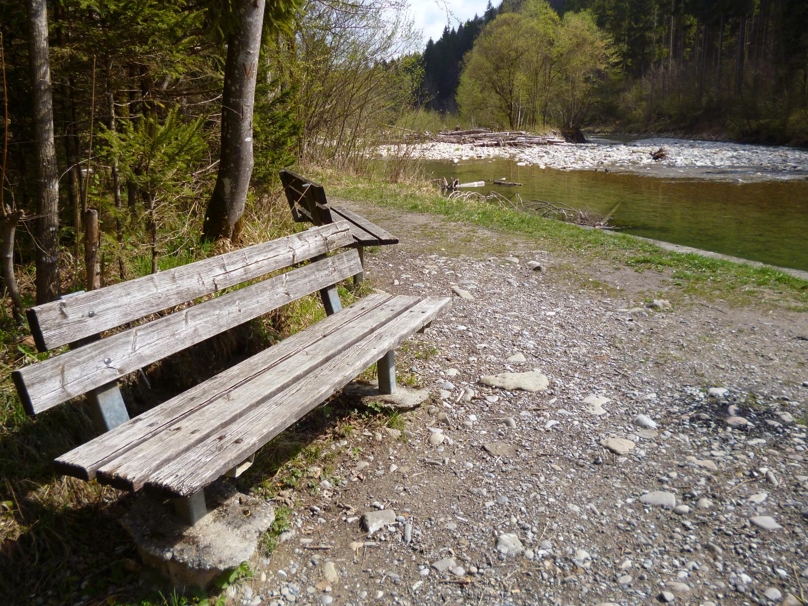

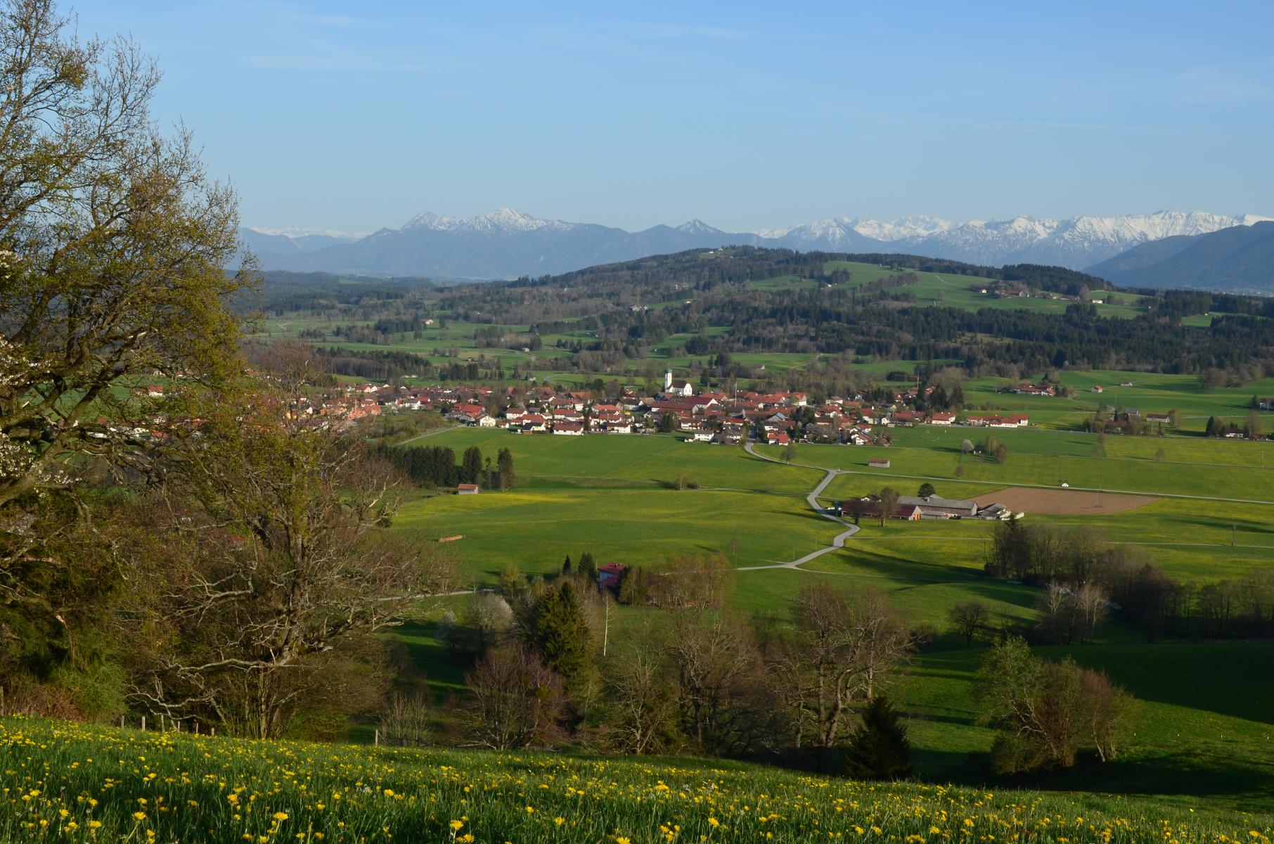
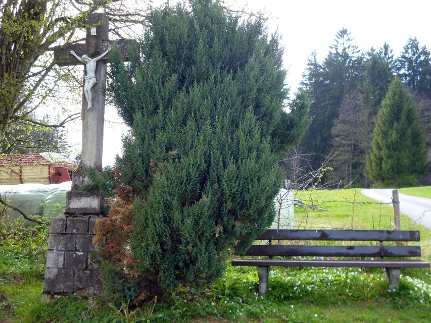
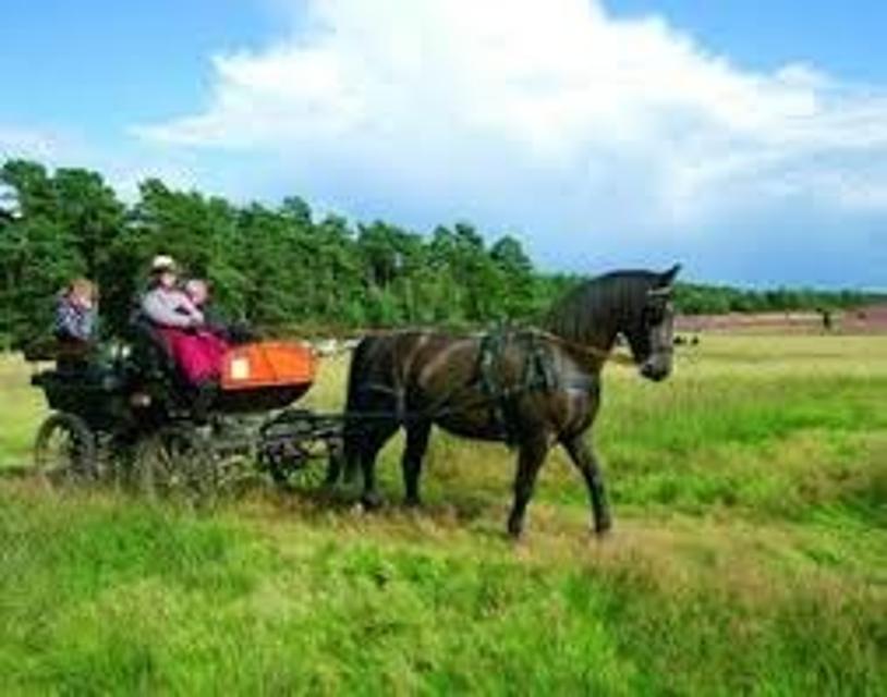
Abwechslungsreicher könnte der bergige Rundweg kaum sein. Gut ausgebaute Panoramastrecken bieten am Anfang und Ende viel Zeit zum Schauen und Genießen. Dazwischen erwarten Wanderer mitunter steile Wurzel- und Treppenpfade durch den Wald, die bis hinunter an die Ammer und bis hinauf auf den Schnalz-Gipfel (901 m) führen.
Beschildert: Nr. 89, blau
-
Aufstieg: 350 hm
-
Abstieg: 350 hm
-
Länge der Tour: 7,7 km
-
Höchster Punkt: 898 m
-
Differenz: 256 hm
-
Niedrigster Punkt: 642 m
Schwierigkeit
mittel
Kondition
mittel
Panoramablick
mittel
Saisonale Eignung
-
JAN
-
FEB
-
MRZ
-
APR
-
MAI
-
JUN
-
JUL
-
AUG
-
SEP
-
OKT
-
NOV
-
DEZ
Merkmale Touren
Aussichtsreich
Rundweg
Familientauglichkeit
Parkplatz in Böbing. Von hier zu Fuß nach Leithen (ca. 1,5 km). In Leithen gibt es keine ausreichenden Parkplätze.
aus Richtung Osten: Auf der A95 bis zur Ausfahrt Sindelsdorf, weitet auf der B472 bis Spatzenhausen, über Uffing/Schöffau weiter nach Böbing.
Mit öffentlichen Verkehrsmitteln: Mit dem Zug nach Weilheim, weiter mit dem Bus nach Böbing. Von hier zu Fuß nach Leithen (1,5 km).
Startpunkt: Am Westrand von Leithen
Ziel: Am Westrand von Leithen
Navigation starten:


Hier befindet sich auch


Essen in der Nähe
"Essen in der Nähe" überspringen


ca. 4,7 km entfernt
Bäckerei & Café Sesar
Bahnhofstraße 21, 86971 Peiting, Germany
Handwerklich-traditionelle Backkunst aus Peiting.

ca. 4,9 km entfernt
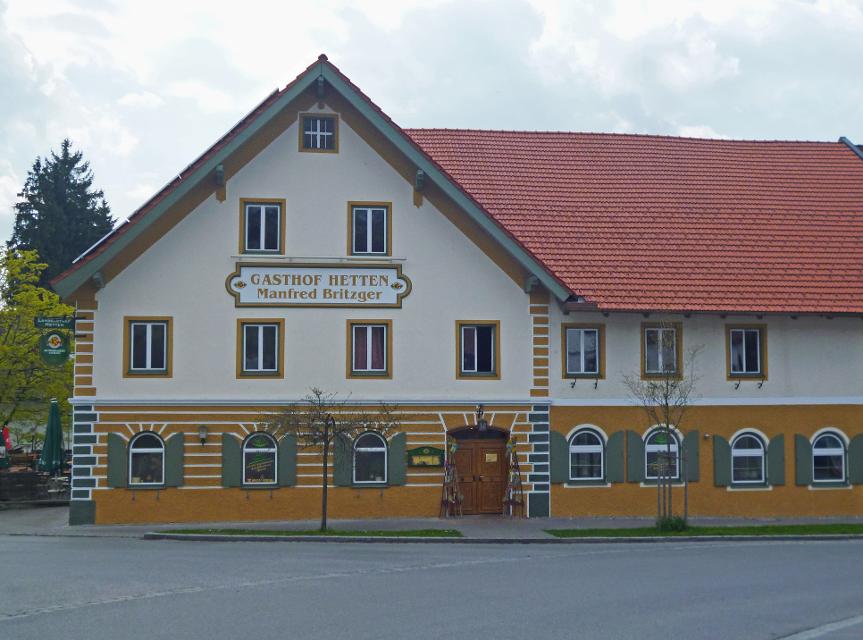
Gaststätte Bayerischer Rigi
M. Günther-Pl. 2, 82383 Hohenpeißenberg, Germany
Schweinshaxe, Jägerbraten und Staffelseezander im zünftigen Wirtshaus mit Panoramaterrasse auf 1000 m Höhe.

ca. 5,3 km entfernt
Hotel-Restaurant „Zum Dragoner“ OHG
Ammergauer Str. 11 + 16, 86971 Peiting, Deutschland


ca. 5,8 km entfernt
Schönegger Käsealm
Schönegg 6, 82401 Rottenbuch, Germany
Die Schönegger Käse-Alm ist nicht nur eine Station des Pfaffenwinkler Milchweges, sondern der Ort, an dem reine Heumilch aus der Region zu Käse verarbeitet wird. In der Schaukäserei können Interessierte den Prozess der Käseherstellung dienstags und donnerstags verfolgen und die fertigen Produkte anschließen im Verkauf erwerben. Für Hungrige gibt es Leckereien, die in der Brotzeitstube und im Biergarten verzehrt werden können. Ein Highlight für Kinder ist der Streichelzoo, der neben dem Spielplatz und dem Kräutergarten auf der Käse-Alm einen festen Platz eingenommen hat.


ca. 6,9 km entfernt
Herzog Cafe und Wirtshaus in Herzogsägmühle
Dorfplatz 8, 86971 Peiting-Herzogsägmühle, Germany
Das Café Herzog ist das öffentliche Café und Wirtshaus in Herzogsägmühle, mit Spielplatz, Minigolf und zwei Kegelbahnen. Unsere Speisekarte ist klein, aber fein. Wo immer möglich, verarbeiten wir regionale und nachhaltig erzeugte Produkte – selbstverständlich auch aus Herzogsägmühler Betrieben wie der Metzgerei, der Bäckerei sowie der Gärtnerei.Ebenso stellen wir viele Produkte hausgemacht her – wir haben Freude daran und hoffen, Sie mit unseren Speisen ein wenig verwöhnen zu können.Wir bieten Frühstück, Mittagessen und am Nachmittag können Sie sich auf erfrischende Eisbecher sowie hausgemachten Kuchen freuen. Unser barrierefreies Restaurant wurde mehrfach für seinen kinder- und familienfreundlichen Service ausgezeichnet.

ca. 7,7 km entfernt
Gasthof Sonne
Hauptstraße 92, 82380 Peißenberg, Germany
Gemütliches Hotel und Gasthaus Sonne in Peißenberg südlich vom Ammersee. Moderne Zimmer, Restaurant, Natur

ca. 8,0 km entfernt
Lagerhaus
Karmeliterstr. 5, 86956 Schongau, Germany
Restaurant, mit Cafe und Bar. Seit dem Umbau kann das Lagerhasu auch mit einem Kinobesuch der besonderen Art aufwarten.

ca. 8,0 km entfernt

ca. 8,1 km entfernt
Unterkünfte in der Nähe
"Unterkünfte in der Nähe" überspringen


ca. 3,4 km entfernt
Ferienwohnung Donderer
Franz-von-Heeren-Str. 1, 82401 Rottenbuch, Deutschland


ca. 4,2 km entfernt
Terrassencamping am Richterbichl
82401 Rottenbuch, Germany
Der 4-Sterne Campingplätze lässt keine Wünsche offen.


Weitere Tipps in der Nähe
"Weitere Tipps in der Nähe" überspringen

ca. 0,9 km entfernt
Erlebnisse mit Eseln - Tippeltours
Thalmühlweg 36, 82389 Böbing, Germany
Zusammen mit Paolo und Pepito haben Groß und Klein Spaß an Entdeckungstouren rund um Böbing.


ca. 1,2 km entfernt
Kneippen für Jung & Alt auf dem Stroblhof
Herkulan-Schwaiger-Weg 12, 82389 Böbing-Pischlach, Germany
Kinder von heute sind gesundheitsbewusste Erwachsene von Morgen


ca. 1,3 km entfernt


ca. 1,7 km entfernt
Ponyreiten auf dem Stroblhof
Herkulan-Schwaiger-Weg 12, 82389 Böbing, Germany
Auf unserem zertifizierten Erlebnisbauernhof dürfen Kinder auf dem hofeigenen Reitplatz Ponyreiten und lernen dabei auch den Umgang und die Pflege vom Pferd.


Das könnte Dir auch gefallen
"Das könnte Dir auch gefallen" überspringen
Sonnenbichl-Weg
Der Sonnenbichl-Weg ist eine erstklassige Panoramarunde. Bis auf wenige Abschnitte werden Spaziergänger auf der gesamten Strecke von einem grandiosen Bergblick begleitet. Vom Aussichtspunkt in Geigersau, der nicht umsonst Dreiseenblick genannt wird, eröffnet sich ein eindrucksvoller Blick nach Norden bzw. Osten auf Ammersee, Starnberger See und Staffelsee. Beschildert: Nr. 93, blau
2:30 h 175 hm 151 hm 10,0 km mittel

Doktor-Faustus-Weg
Der Doktor-Faustus-Weg wurde nach den Ortsbeschreibungen im Roman angelegt, die durch Thomas und Viktor Mann eindeutig für Polling verbürgt sind. Der landschaftlich reizvolle Rundweg berührt alle Orte, die Thomas Mann im Zusammenhang mit Geburts- und Wohnort seiner Titelfigur Adrian Leverkühn erwähnt. Man wandert auf den Spuren eines bedeutenden Werkes der Weltliteratur - im Spannungsfeld zwischen Realität und Kunstfigur. Mit 13 Texttafeln bietet der Themenweg unterhaltsame Erholung in intakter Kulturlandschaft.
1:30 h 60 hm 60 hm 4,6 km sehr leicht

Enzianweg
Der landschaftlich reizvolle Rundweg hat allerlei Abwechslung zu bieten: weitläufige Wiesen, Felder und Moore, ein idyllisch gelegener See, ein erfrischender Badeweiher, zwei malerische Kapellen und nicht zuletzt ein fantastisches Bergpanorama. So geht es auf ruhigen, größtenteils asphaltierten Wegen genussvoll durch die wunderschöne Landschaft nordöstlich von Obersöchering. Beschildert: Nr. 11, blau
2:00 h 22 hm 22 hm 8,5 km sehr leicht
")
Hardtrunde (kurz)
Die kurze Version der Hardtrunde streift die typische Hardtlandschaft östlich von Weilheim nur am Rande. Im Zentrum steht vielmehr das sanfte Hügelland rund um den idyllischen Dietlhofer See, einem beliebten Badesee im Norden von Weilheim. Immer wieder genießen Spaziergänger wunderschöne Ausblicke auf den See und den Weiler Dietlhofen. Beschildert: Nr. 42, grün
1:00 h 47 hm 47 hm 3,9 km sehr leicht

Illach-Rundweg
Der flache Rundweg nahe der Illach führt Wanderer durch die weitläufige Landschaft des Pfaffenwinkels. Während Kulturinteressierte in Steingaden die Spuren der Welfendynastie erforschen können, ist für Naturliebhaber der türkisfarbene Lechstausee eine wunderbare Sehenswürdigkeit. Ausgeschildert mit der Nr. 120, rot.
2:30 h 154 hm 154 hm 9,4 km mittel

Königssträßle-Rundweg
Die panoramareiche Runde führt auf ruhigen Wegen durch die hügelige Voralpenlandschaft des südlichen Pfaffenwinkels. Grandiose Bergblicke und die weit über die Grenzen Bayerns hinaus bekannte Wieskirche ziehen Spaziergänger in ihren Bann. Beschildert: Nr. 117, blau
2:30 h 173 hm 173 hm 9,8 km mittel

Lanzenbachweg
Idyllisch führt die Runde, die auf den Schildern mit der Nr. 8 auf blauem Grund zu finden ist, in stetem Auf und Ab durch die Wald- und Wiesenlandschaft östlich des Pollinger Weihers. Immer wieder genießen Spaziergänger traumhafte Ausblicke auf die Alpenkette. Im Reinthaler Bauernhofmuseum können allerlei alte landwirtschaftliche Geräte bestaunt werden. Direkt nebenan lohnt sich eine Einkehr im dazugehörigen Café. Beschildert: Nr. 8, blau
2:15 h 128 hm 128 hm 8,6 km mittel

Lauterbach-Rundweg
In Steingaden beginnt der Rundweg nach Lauterbach. Vom Startpunkt führt der Weg über wenig befahrene Sträßchen und Forstwege nordöstlich von Steingaden. Ein Begleiter der Tour ist der grandiose Weitblick auf die Alpen und auf das Welfenmünster. Ausgeschildert ist der Weg mit der Nr. 119, blau.
2:15 h 142 hm 142 hm 7,3 km mittel

Moor- und Drumlinrunde Eberfing
Die ausgedehnte Spazierrunde bei Stadel ist eine Runde durch die weitläufigen Filzgebiete und romantische Wälder im bayerischen Oberland nahe des Starnberger Sees. Auf der Rundwanderung darf man die sanfte Hügellandschaft im malerischen Voralpenland kenne lernen. Der Stadler Weiher ist das Highlight der Tour und einen Abstecher für einen Sprung in das kühle Nass wert. Beschildert: T16, blau
2:30 h 60 hm 58 hm 8,2 km mittel

Panoramaweg Schellenberg
Der Panoramaweg über den Schellenberg wird seinem Namen mehr als gerecht. Schon vom Weg aus, erst recht aber auf dem Schellenberg genießen Spaziergänger einen fantastischen Blick auf die Alpen und den Hohen Peißenberg. Beschildert: Nr. 17, grün
1:00 h 48 hm 48 hm 4,1 km sehr leicht

Schäfflerweg
Der Schäfflerweg ist eine wunderschöne Wanderrunde mit Start in Peißenberg, der Marktgemeinde des lebendig gebliebenen Bergbaus.
3:15 h 235 hm 235 hm 10,7 km mittel

Schnalz-Panoramaweg Peiting
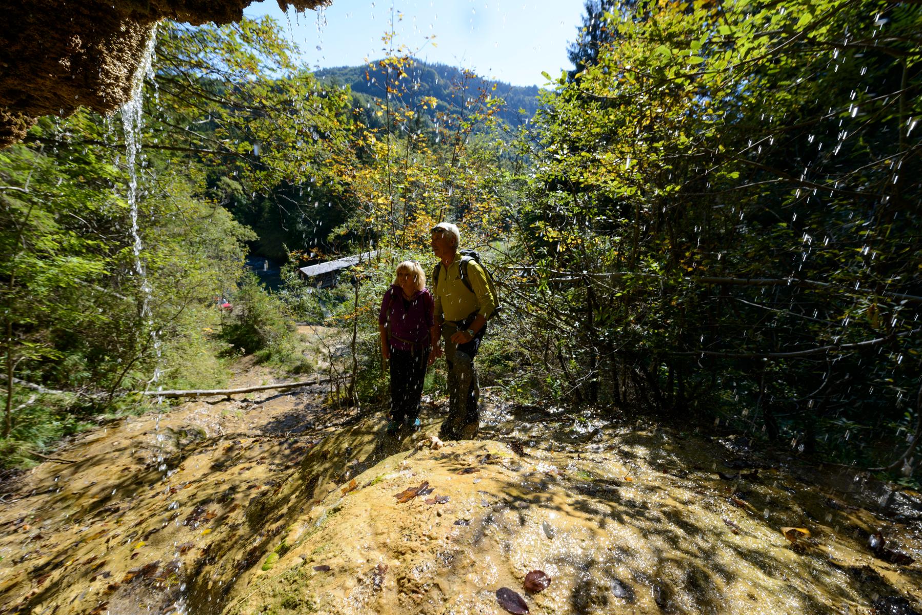
Abwechslung und Spannung ist auf dem ausgedehnten Rundweg garantiert. Zwischen saftig grünen Wiesen und schattigen Wäldern führt er bis an die wildromantische Ammer hinunter, wo mit dem Ammerlauf-Lehrpfad noch eine informative Extra-Runde gedreht wird. Auf dem Weg in Richtung Schnalz-Gipfel stellen die unzähligen Stufen einen echten Konditionstest dar. ‘Beschildert: Nr. 101, blau
3:30 h 412 hm 412 hm 10,2 km mittel

Seewiesenweg
Die gemütliche Spazierrunde ist zwar kurz, aber dafür umso abwechslungsreicher. Begleitet von einem traumhaften Alpenpanorama führt der Weg nach Huglfing, bevor es durch die einzigartige Grasleitner Moorlandschaft zurück nach Oberhausen geht. Beschildert: Nr. 63, grün
1:00 h 47 hm 47 hm 4,0 km sehr leicht

Storchenweg
Auf dem kurzen, flachen Rundweg genießen Spaziergänger über den freien Felder und Wiesen nordöstlich von Raisting ein traumhaftes Bergpanorama. Wer im Frühling oder Frühsommer unterwegs ist, kann mit etwas Glück häufig Störche beobachten, die während dieser Zeit in einem der zahlreichen Horste in und um den Ort nisten. Beschildert: Nr. 50, grün
1:00 h 22 hm 22 hm 4,1 km sehr leicht

Wald-Wanderweg
Der Wald-Wanderweg führt uns auf ruhigen Forstwegen durch idyllische Wälder. Die gemütliche Runde führt um die Ortschaft Raisting, die für ihre Erdfunkstelle große Bekanntheit genießt. Die weit sichtbaren Parabolantennen sind ein Wahrzeichen des Weilheimer Landes. Beschildert: Nr. 53, blau
1:30 h 64 hm 64 hm 6,8 km mittel

Bergwetter-Weg
In exponierter Lage führt die Spazierrunde auf gut beschilderten Wegen zu den spannenden Sehenswürdigkeiten des Hohen Peißenbergs. Auf der Runde erwartet uns die älteste Bergwetterstation der Erde, eine Entdeckungsreise durch die Welt des Klimas und die Wallfahrtskirche Maria Himmelfahrt. Beschildert: Nr. 82, blau
1:30 h 196 hm 196 hm 4,8 km sehr leicht

Erdfunkstellen-Wanderweg
Die eindrucksvolle, durchaus außergewöhnliche Spazierrunde führt einmal rund um die schon von Weitem sichtbare Erdfunkstelle südlich von Raisting. Mitten auf der grünen Wiese stehen hier riesige Antennen, welche bis heute für internationale Satellitenverbindungen und damit für weltweite Kommunikation genutzt werden. Beschildert: T51, grün
1:15 h 22 hm 22 hm 5,0 km sehr leicht
")
Hardtrunde (lang)
Die ausgedehnte Runde führt über weite Strecken durch die einzigartige Hardtlandschaft mit Hoch- und Niedermooren, Magerrasen- und Streuwiesengebieten sowie weitläufigen Wäldern. Auf dem landschaftlich äußerst reizvollen Weg über kaum befahrene Sträßchen und ruhige Forstwege genießen Spaziergänger immer wieder traumhafte Ausblicke auf die Alpenkette. Beschildert: Nr. 44, rot
2:30 h 109 hm 109 hm 9,6 km mittel

Hardtrunde (mittel)
Die landschaftlich reizvolle Hardtrunde führt in ihrem östlichen Teil durch die wunderschöne, äußerst vielfältige Hardtlandschaft. Saftig grüne Wiesen wechseln sich immer wieder mit weitläufigen Wald- und Moorgebieten ab. Im Gegensatz dazu ist der westliche Teil der Runde geprägt durch die weiten, häufig landwirtschaftlich genutzten Felder und Wiesen rund um den Dietlhofer See, der sich im Sommer hervorragend zum Baden eignet. Beschildert: Nr. 43, blau
2:00 h 88 hm 88 hm 7,1 km sehr leicht

Kirchen-Rundweg Iffeldorf
Das Ziel des kurzen Rundwegs ist die Wallfahrtskirche St. Maria im Heuwinkl. Die als Heuwinklkapelle bekannte Kirche liegt wunderschön auf einer Anhöhe östlich von Iffeldorf. Sie gilt als eine der schönsten Kapellen im gesamten bayerischen Oberland. Durch ihre exponierte Lage und ihren originellen runden Bau mit der großen roten Kuppel ist sie schon von Weitem sichtbar. Beschildert: Nr. 24, grün
0:45 h 39 hm 39 hm 2,8 km sehr leicht

Panoramarunde Steingaden
Die Panoramarunde führt uns von Steingaden zum Lechstausee. Sobald wir Steingaden verlassen haben und den Storchenmoosweiher passiert haben, öffnet sich uns ein gigantisches Alpenpanorama, das uns bis zum Ausgangspunkt zurück begleiten wird. Beschildert: Nr. 115, blau
2:15 h 95 hm 92 hm 7,6 km mittel

Peitnachrunde
Die Tour führt von Peiting zum Kalvarienberg und an der Peitnach entlang. Eine malerische Runde mit Alpenblick und Sicht auf den Hohen Peißenberg. Vor allem für Familien mit Kindern ist der Walderlebnispfad auf dem Kalvarienberg ein spannendes Erlebnis. Beschildert: Nr. 100, grün
2:00 h 147 hm 149 hm 6,4 km mittel

Pfaffenwinkler Milchweg
Auf dem Pfaffenwinkler Milchweg bei Schönegg können Wanderer alles rund um das Thema Milch Schritt für Schritt erleben. Auf dem Themenweg gibt es zehn Stationen, die Wissenswertes und Spannendes rund um das Thema Milch und Landwirtschaft kindgerecht präsentieren.
1:30 h 88 hm 89 hm 4,2 km sehr leicht

Reitersau-Rundweg
Auf dem ruhigen Rundweg durchstreifen Spaziergänger die sanfte Hügellandschaft südlich von Steingaden. Das Welfenmünster in dem ehemaligen Klosterdorf gilt als eine der bedeutendsten Sehenswürdigkeiten im gesamten Pfaffenwinkel. Beschildert mit der Nr. 121, blau
1:30 h 111 hm 111 hm 6,7 km sehr leicht


Rundweg um den Fohnsee
Inmitten des Naturschutzgebiets Osterseen bietet der Rundweg um den Fohnsee ein einzigartiges Naturerlebnis. Spaziergänger genießen immer wieder traumhafte Blicke über die weitläufige Seenlandschaft. Zahlreiche idyllische Plätze am Ufer des Fohnsees und des Großen Ostersees locken zum Verweilen. Beschildert: Nr. 23, grün
1:15 h 41 hm 41 hm 4,9 km sehr leicht

Stadt- und Lechgeschichten
Wissenswerte Geschichten ranken sich um die historische Altstadt Schongaus. Zuerst erleben wir jedoch romantische Wanderwege, ehe wir die Altstadt mit dem gotischen Ballenhaus, der barocken Stadtpfarrkirche Mariae Himmelfahrt und der begehbaren Stadtmauer entdecken.
3:45 h 276 hm 276 hm 13,9 km mittel

Stadt- und Waldrunde
Die ausgedehnte Stadt- und Waldrunde in und um Penzberg wartet mit abgelegenen Aussichtspunkten, traumhaften Gewässen und weitläufigen Filzgebieten in Stadtnähe auf. Im Erholungsgebiet Berghalde wandert man auf den Spuren des Bergbaus und erfährt Wissenswertes zur Geschichte der Stadt Penzberg. Für junge Wanderer ist das Freizeitgebiet Gut Hub eine spannende Abwechslung. Beschildert: Nr. 1, rot
4:45 h 225 hm 225 hm 18,2 km mittel